


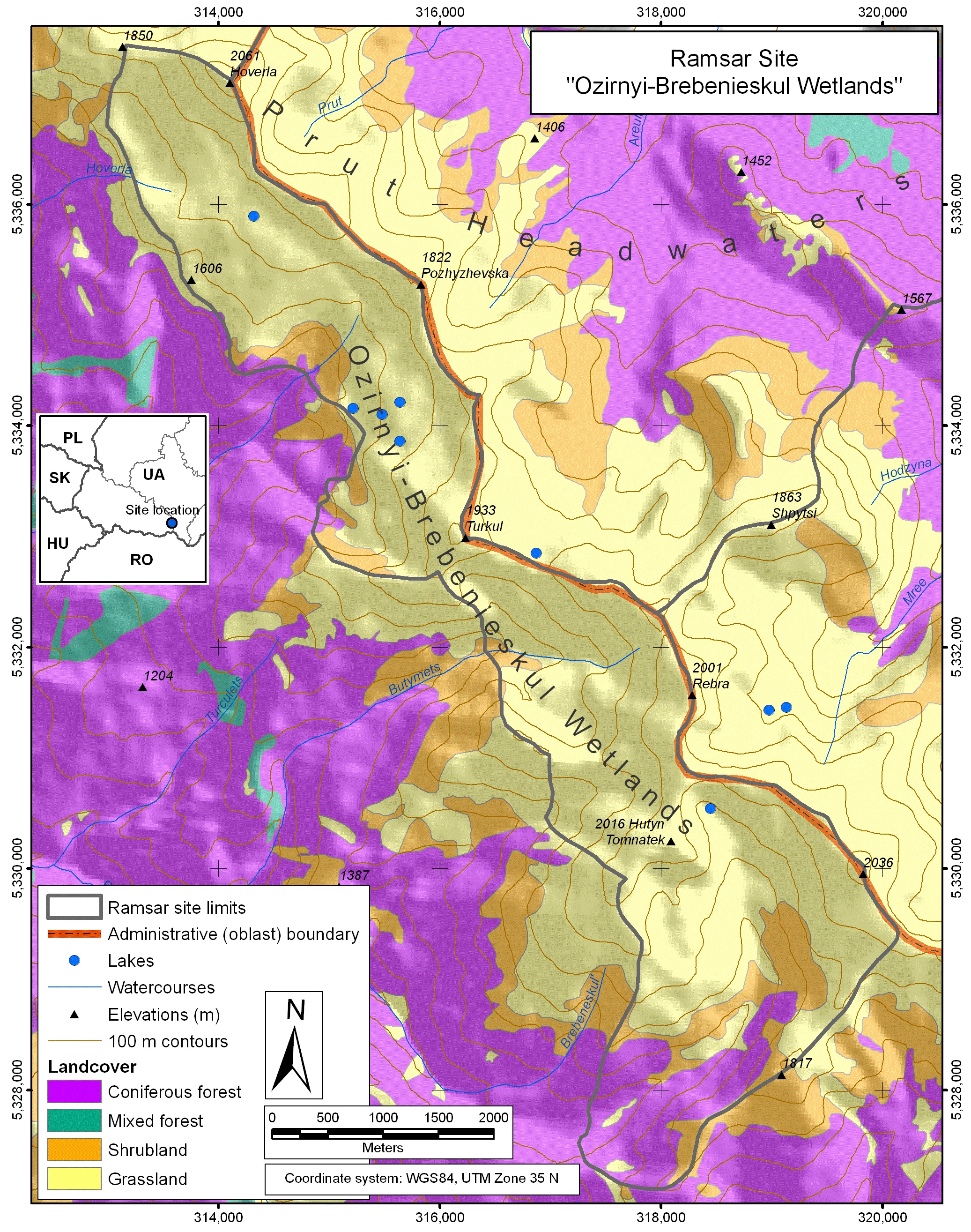
Ozirnyi-Brebeneskul
- Country:Ukraine
- Site number:2394
- Area:1,656.9 ha
- Designation date:04-04-2019
- Coordinates:48°06'N 24°32'E
Materials presented on this website, particularly maps and territorial information, are as-is and as-available based on available data and do not imply the expression of any opinion whatsoever on the part of the Secretariat of the Ramsar Convention concerning the legal status of any country, territory, city or area, or of its authorities, or concerning the delimitation of its frontiers or boundaries.
Overview
Ozirnyi-Brebeneskul is a highland wetland composed of a dense river network, several large lakes of glacial origin, marshlands, swamps and peatlands. It is located in the Chornohora mountain range, on the southern slope of the Hoverla, the highest mountain in Ukraine at 2,061 metres. The glacial lakes are the largest and deepest of the Ukranian Carpathians. The Site is also characterized by a large variety of flora, including 500 species of vascular plants, 42 of which are listed in the national Red List. The Site is visited by 100,000 people annually, as the most popular tourist trail in Ukraine passes through. This gives the Site recreational value, but also leads to trampling of plants, pollution and ecosystem disturbance. Ozirnyi-Brebeneskul is located within the Carpathian Biosphere Reserve, which controls the access and use of its natural resources.
Administrative region:
Zakarpatska oblast (Transcarpathian region)
- Global international designation:
- UNESCO Biosphere Reserve
- National legal designation:
- Biosphere Reserve - Carpathian
- Last publication date:23-08-2019