


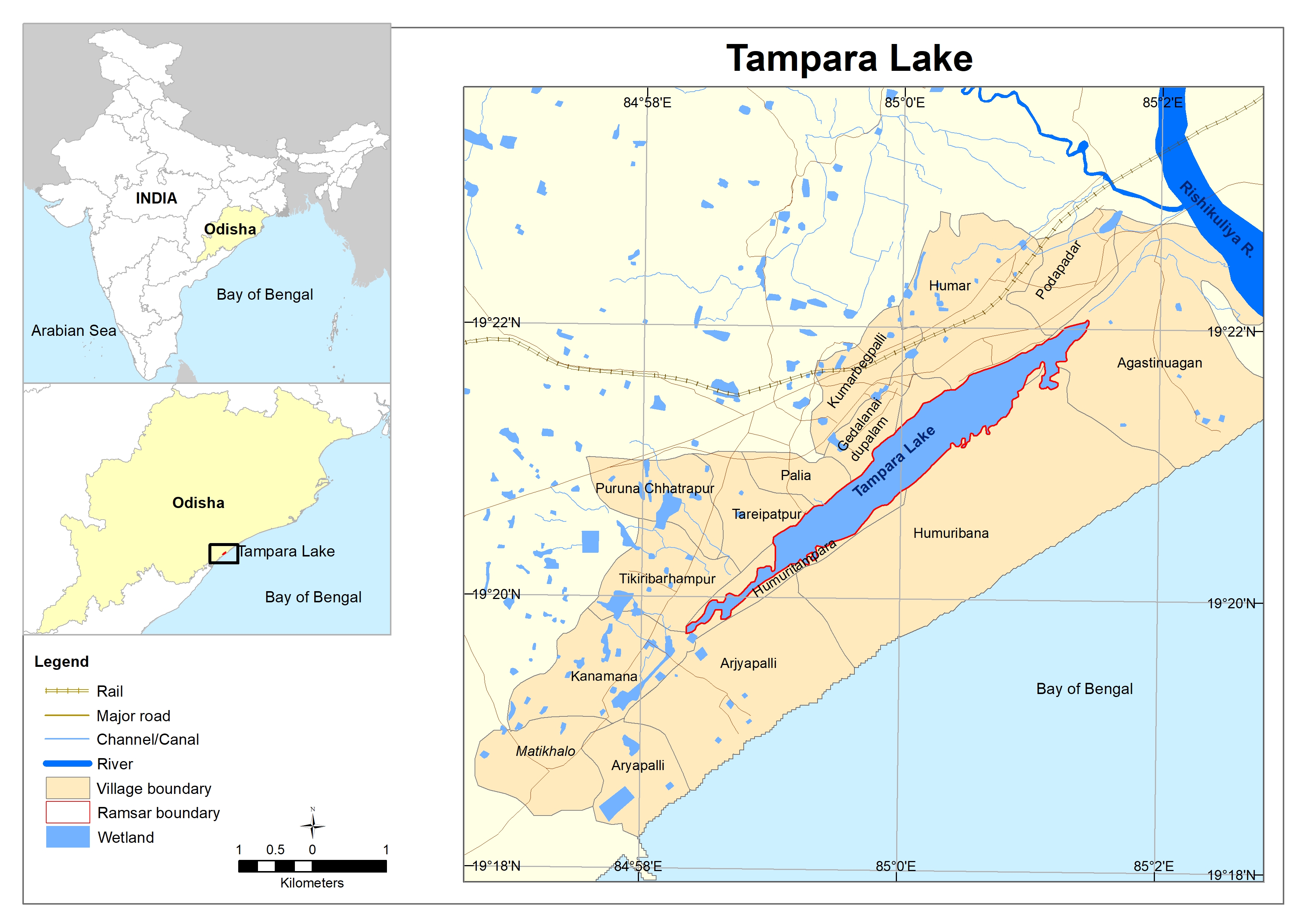
Tampara Lake
- Country:India
- Site number:2489
- Area:300 ha
- Designation date:12-10-2021
- Coordinates:19°21'N 85°00'E
Materials presented on this website, particularly maps and territorial information, are as-is and as-available based on available data and do not imply the expression of any opinion whatsoever on the part of the Secretariat of the Ramsar Convention concerning the legal status of any country, territory, city or area, or of its authorities, or concerning the delimitation of its frontiers or boundaries.
Overview
The use of explosives during a battle in the Ganjam district between the British East India Company and French colonists in 1766 created a large depression which later became Tampara Lake. The lake is now connected to the Rushikulya river and helps in flood control during the monsoon season. The lake receives flood waters coming from the river, making its biodiversity highly vulnerable to extreme heat and dry weather. The wetland supports 60 species of birds and 46 fish species, including vulnerable species such as common carp (Cyprinus carpio), common pochard (Aythya ferina) and river tern (Sterna aurantia). With an estimated average fish yield of 12 tonnes per year, the wetland is an important source of livelihoods for the local communities. Along with fish, the wetland also provides water for agriculture and domestic use and is used for recreation. It also provides a water pathway for local transportation of goods.
Administrative region:
Ganjam District, Odisha,India
- Last publication date:31-10-2022
Downloads
Ramsar Information Sheet (RIS)
Additional reports and documents
- Taxonomic lists of plant and animal species occurring in the site
- A description of the site in a national or regional wetland inventory