


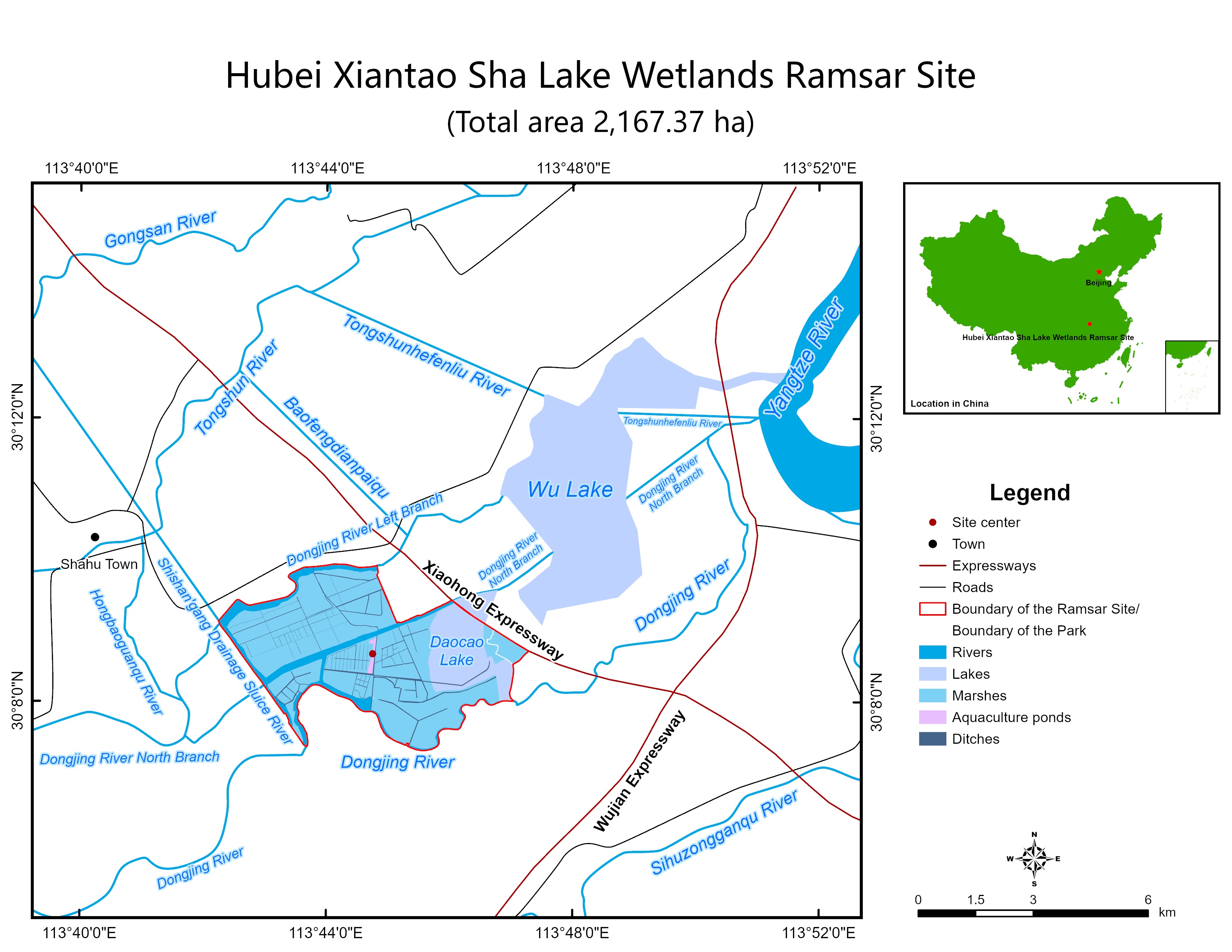
Hubei Xiantao Sha Lake Wetlands
- Country:China
- Site number:2510
- Area:2,167.4 ha
- Designation date:28-10-2022
- Coordinates:30°08'N 113°44'E
Materials presented on this website, particularly maps and territorial information, are as-is and as-available based on available data and do not imply the expression of any opinion whatsoever on the part of the Secretariat of the Ramsar Convention concerning the legal status of any country, territory, city or area, or of its authorities, or concerning the delimitation of its frontiers or boundaries.
Overview
Located in the Jianghan Plains, the Site connects in the east to the middle reaches of the Yangtze River and in the west the Han River, two of the main river systems of the country. The Site contains the Daocao Lake, the Dongijing River, and its surrounding marshland area, where herbaceous marshes dominate. Due to the hydrological connectivity of the Site and the predominant marshes, 72 species of spawning, migrant and resident fish are found, among them the threatened Asian swamp eel (Monopterus albus) and aischgrund carp (Cyprinus carpio). The Site also offers abundant food resources and habitat for a large number of birds migrating between East Asia and Australia, including the critically endangered Baer’s pochard (Aythya baeri). The herbaceous marshes harbour 1,000 hectares of reeds that promote sedimentation and nutrient retention of run-off catchment water, and are used as raw materials by some 130 farms. The Site also helps in flood regulation of the Yangtze River, ensuring flood security for its lower reaches.
Administrative region:
Xiantao City, Hubei Province
- National legal designation:
- National Wetland Park - Hubei Xiantao Sha Lake National Wetland Park
- Last publication date:11-04-2023
Downloads
Ramsar Information Sheet (RIS)
Site map
Additional reports and documents
- Taxonomic lists of plant and animal species occurring in the site