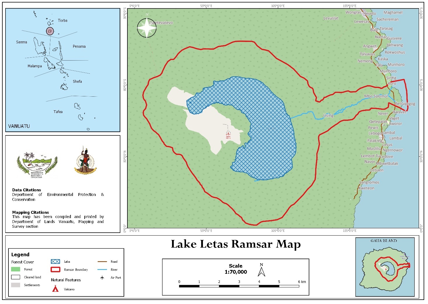
Lake Letes
Lake Letes
- Country:
- Vanuatu
- Site number:
- 2524
- Area:
- 8,248.1 ha
- Designation date:
- 15-09-2023
- Coordinates:
- 14°16'47"S 167°31'46"E
Carousel
Carousel


Materials presented on this website, particularly maps and territorial information, are as-is and as-available based on available data and do not imply the expression of any opinion whatsoever on the part of the Secretariat of the Ramsar Convention concerning the legal status of any country, territory, city or area, or of its authorities, or concerning the delimitation of its frontiers or boundaries.
This Site encompasses the caldera of Mount Garet, an active stratovolcano on the island of Gaua, and is a representative geothermal wetland system of the biogeographic region. It comprises a permanent freshwater lake, which is the largest in the Pacific Islands region excluding New Guinea, and the entire catchment of the Solomul River which connects the lake to the sea. The caldera of the volcano also features a rainforest with secondary closed scrub vegetation and harbours a threatened tree species, the whitewood (Endospermum medullosum). The Site supports 15 crustaceans and 18 fish, among which two are endemic to Vanuatu, the gobies Schismatogobius vanuatuensis and Stiphodon astilbos. The giant mottled eel (Anguilla marmorata) and the Pacific long-finned eel (A. megastoma) migrate to the lake from the sea for spawning. The Site falls within a Community Conservation Area and is under customary ownership of the indigenous communities which harvest eels and prawns and run small-scale eco-tourism businesses in Gaua. There is also a management plan for the Site.
- Community Conservation Area - Lake Letas Coomunity Conservation Area
- VU2524RIS_2310_en.pdf
- VU2524_map210416.jpg