Pyu Lake
Pyu Lake
- Country:
- Myanmar
- Site number:
- 2533
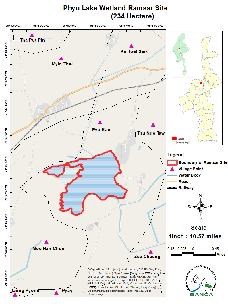
- Area:
- 234.0 ha
- Designation date:
- 02-02-2024
- Coordinates:
- 21°45'57"N 95°53'22"E
Carousel
Carousel


Materials presented on this website, particularly maps and territorial information, are as-is and as-available based on available data and do not imply the expression of any opinion whatsoever on the part of the Secretariat of the Ramsar Convention concerning the legal status of any country, territory, city or area, or of its authorities, or concerning the delimitation of its frontiers or boundaries.
The Site was built in the 11th century as a reservoir for irrigation in the south-west part of the city of Mandalay. It is now found in a semi-urban area of Tada-U Township. Through natural succession, it has developed an ecology similar to a natural wetland; it is a representative permanent freshwater lake of the Irrawaddy moist deciduous forest ecoregion and is heavily influenced by the tropical monsoon. Its aquatic plant communities, dominated by typha beds and dense patches of heart-leaved water lily (Ottelia cordata), support about 60 species of waterbirds including the vulnerable common pochard (Aythya ferina) and four other globally threatened species. Since other nearby wetlands such as the Banaw Inn and Paleik Lake dried out due to unsustainable agricultural practices, the Site has become an important area for wintering birds. It shelters the last wintering population in Myanmar of the critically endangered Baer’s pochard (Aythya baeri). In the 1980s, the Kinda Dam on the Pan Laung River was connected to this Site, which has helped to alleviate flood- and drought-related effects in the region and has provided irrigation to more than 1,560 hectares of surrounding farmland. Solid waste disposal and drought are the major threats.
- MM2533RIS_2402_en.pdf
- MM2533_map230919.jpg