


International Institute of Tropical Agriculture (IITA)
- Country:Nigeria
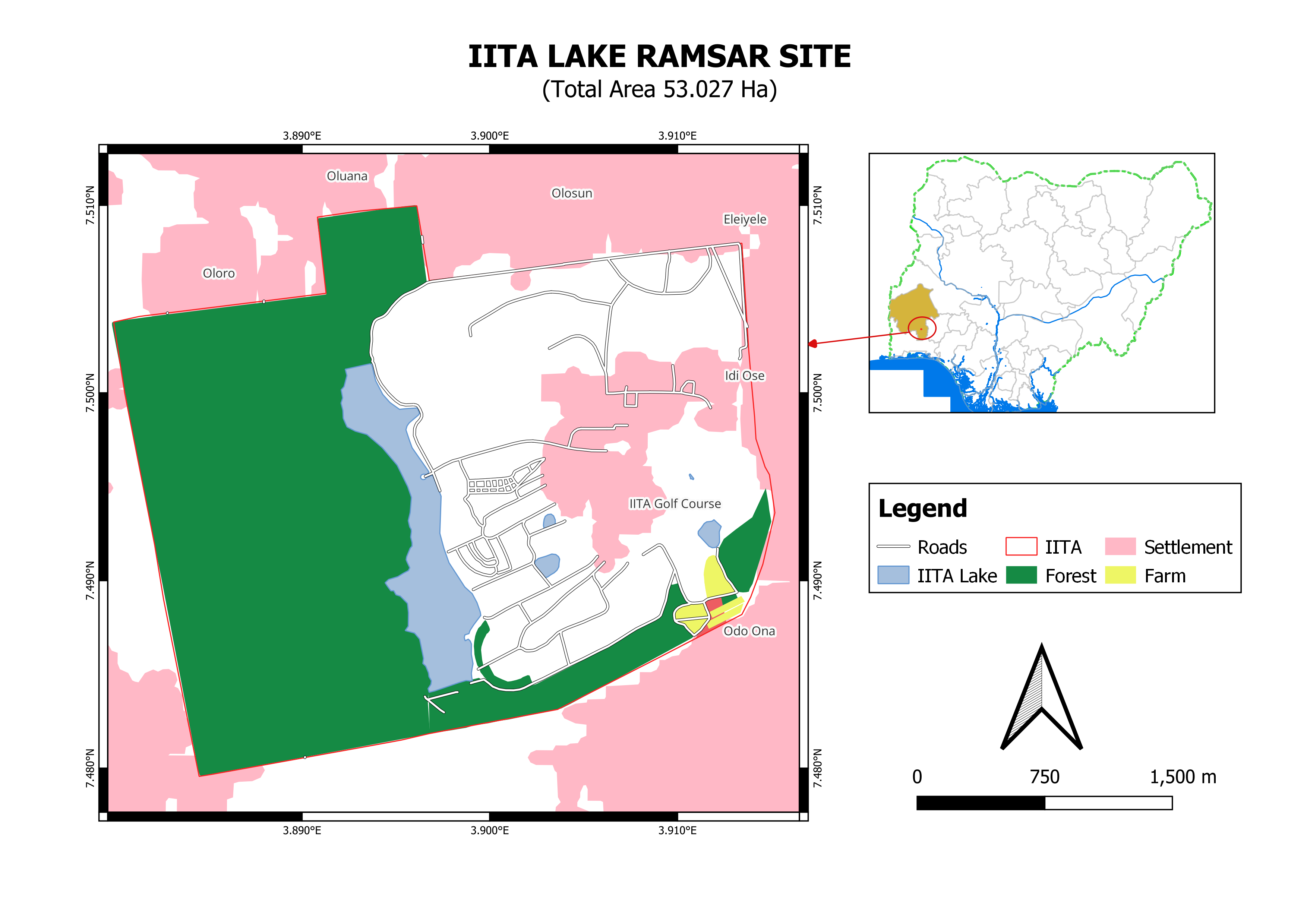
- Site number:2551
- Area:53 ha
- Designation date:01-03-2024
- Coordinates:07°29'N 03°54'E
Materials presented on this website, particularly maps and territorial information, are as-is and as-available based on available data and do not imply the expression of any opinion whatsoever on the part of the Secretariat of the Ramsar Convention concerning the legal status of any country, territory, city or area, or of its authorities, or concerning the delimitation of its frontiers or boundaries.
Overview
This Site encompasses a lake of unique ecological character located on the outskirts of Ibadan, within the campus of the International Institute of Tropical Agriculture. It consists of a well-preserved secondary forest characterized by a humid tropical climate with distinct wet and dry seasons. The forest features scattered emergent trees, including species such as kapok (Ceiba pentandra), African teak (Milicia excelsa) and bamboo palm (Raphia vinifera). The Site also features a large area of savannah that supports fallow fields and experimental agricultural plots. It is home to several waterbird species such as the little grey greenbul (Eurillas gracilis), spotted honeyguide (Indicator maculatus), rufous-sided broadbill (Smithornis rufolateralis) and the endangered Ibadan malimbe (Malimbus ibadanensis). The rainy season, which lasts from March to October, provides suitable conditions for irrigation and other ecosystem services such as provision of drinking water. The Site has a management plan and is mainly used for research and agricultural activities of the Institute.
Administrative region:
Oyo State
- Last publication date:02-09-2024