Menar Wetland Complex
Menar Wetland Complex
- Country:
- India
- Site number:
- 2567
- Area:
- 463.4 ha
- Designation date:
- 19-02-2025
- Coordinates:
- 24°35'53"N 74°05'52"E
Carousel
Carousel


Materials presented on this website, particularly maps and territorial information, are as-is and as-available based on available data and do not imply the expression of any opinion whatsoever on the part of the Secretariat of the Ramsar Convention concerning the legal status of any country, territory, city or area, or of its authorities, or concerning the delimitation of its frontiers or boundaries.
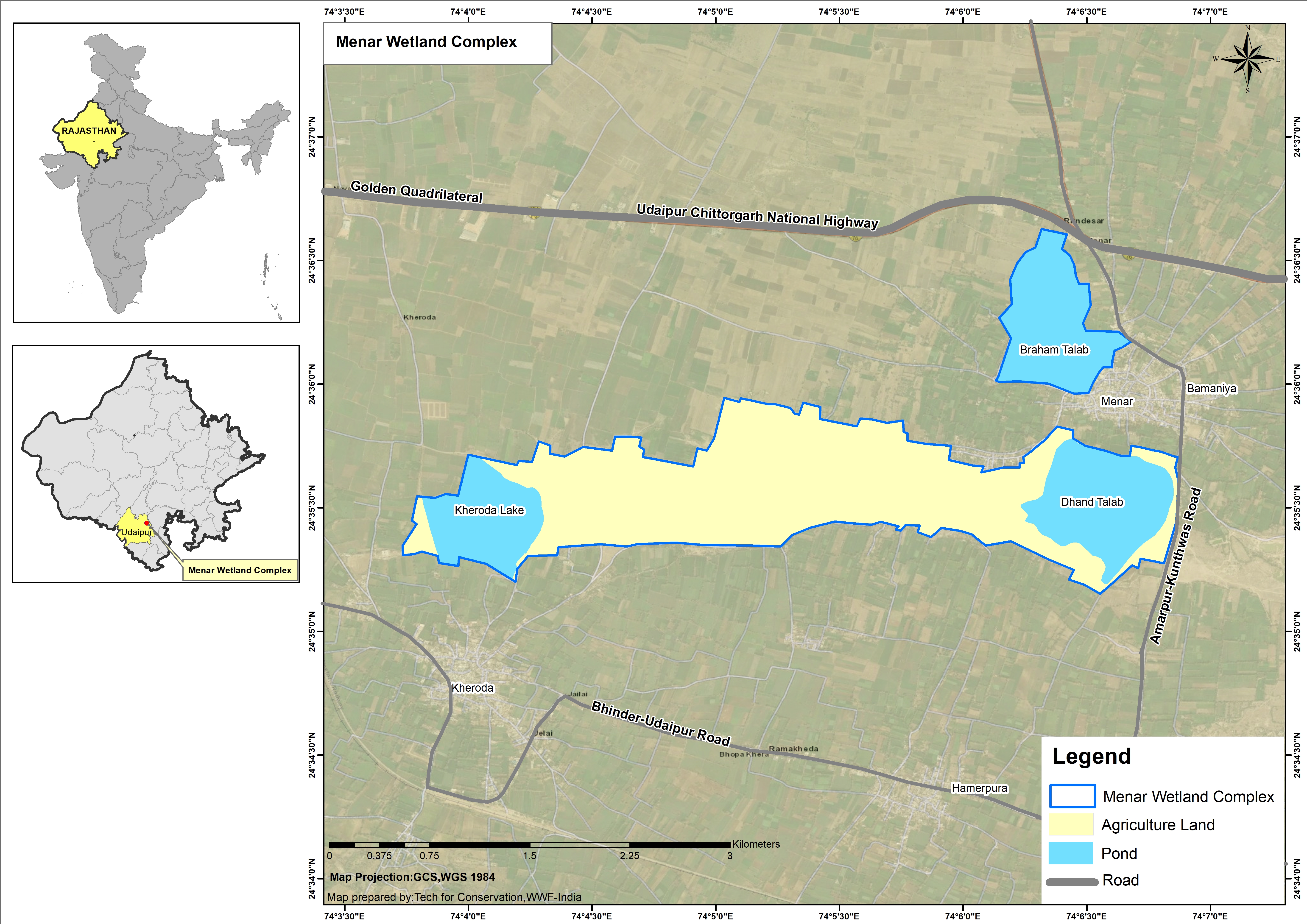
The Site is a freshwater monsoon wetland complex formed by three ponds, Braham talab, Dhand talab and Kheroda talab, and agricultural land that connects the latter two. During the monsoon season the farmland floods, providing habitat for 110 species of waterbirds, of which 67 are migratory. Among the notable bird species at the Site are the critically endangered white-rumped vulture (Gyps bengalensis) and long-billed vulture (Gyps indicus). Over 70 plant species are found, including mango trees (Mangifera indica) around Braham talab that host a large colony of Indian flying fox (Pteropus giganteus). The Site is recognized as one of the best examples of community-led conservation in Rajasthan, with residents of the nearby Menar village playing a key role in conserving wildlife by preventing poaching or fishing.
- IN2567RIS_2506_en.pdf
- IN2567_map250510.jpg