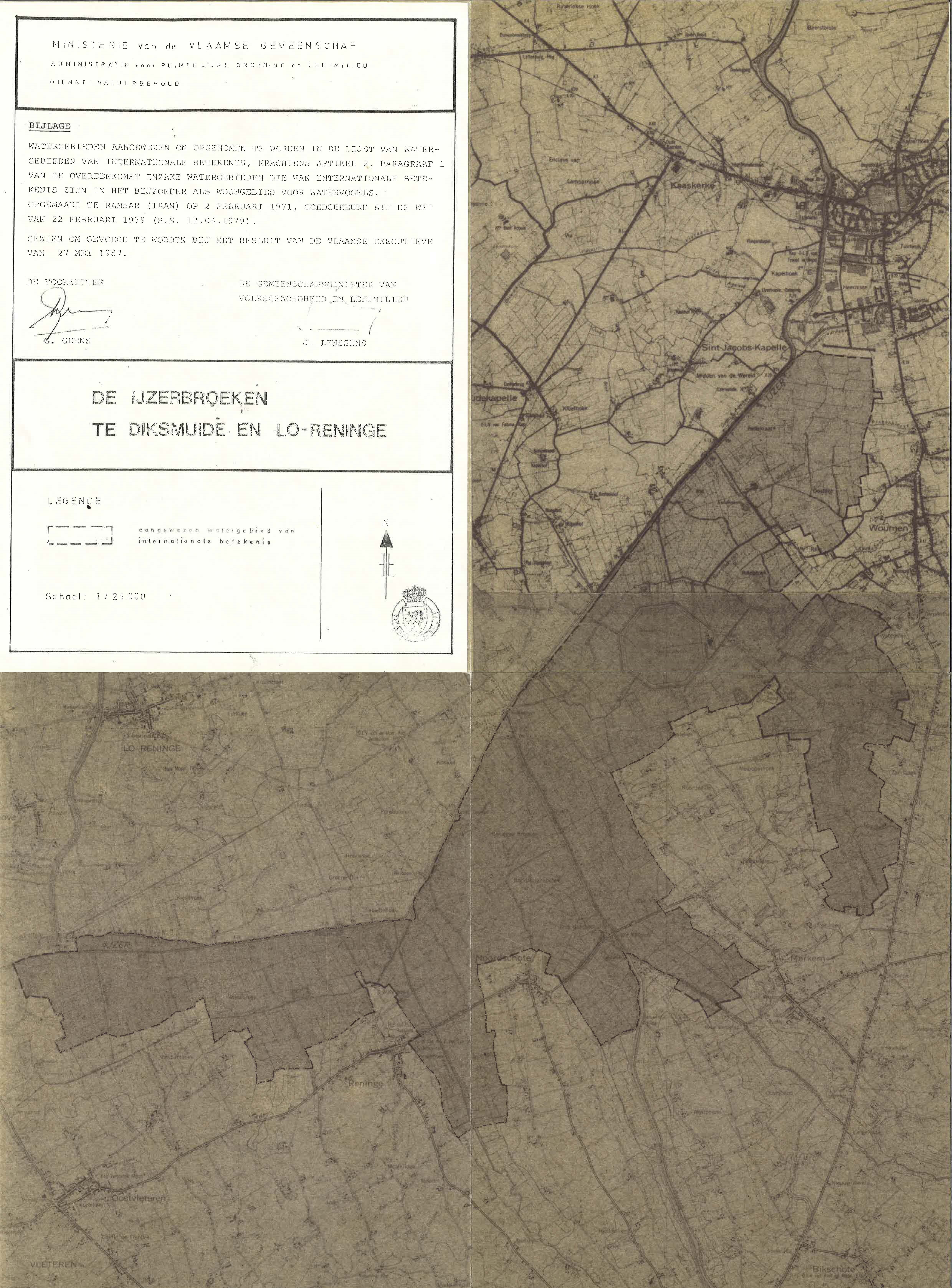
De Ijzerbroeken te Diksmuide en Lo-Reninge
De Ijzerbroeken te Diksmuide en Lo-Reninge
- Country:
- Belgium
- Site number:
- 329
- Area:
- 2,360.0 ha
- Designation date:
- 04-03-1986
- Coordinates:
- 50°58'59"N 02°51'E
Materials presented on this website, particularly maps and territorial information, are as-is and as-available based on available data and do not imply the expression of any opinion whatsoever on the part of the Secretariat of the Ramsar Convention concerning the legal status of any country, territory, city or area, or of its authorities, or concerning the delimitation of its frontiers or boundaries.
De Ijzerbroeken te Diksmuide en Lo-Reninge. 04/03/86; Vlaamse Gewest, 2,360 ha, 50°59'N 002°51'E. Added to the Montreux Record, 4 July 1990, removed from the Record, 17 January 1994, replaced on the Record, 17 May 1999. Special Protection Area EC Directive; Nature Reserve. A shallow, freshwater lake resulting from peat-cutting since the 16th century. Composed of extensive reedbeds and scrub and surrounded by a wet meadow complex. The area supports an interesting flora including rare species, and is particularly important for breeding, staging and wintering birds; nesting species include ducks. The site includes a 60ha water-supply reservoir. Human activities include intense hunting and agriculture. Ramsar site no. 329. Most recent RIS information: 1992.
Administrative region:
West-Vlaanderen
National legal designation:
- nature reserve
Regional (international) legal designations:
- EU Natura 2000
Last publication date:
01-01-1992
Ramsar Information Sheet (RIS)
- BE329RIS.pdf
Site map