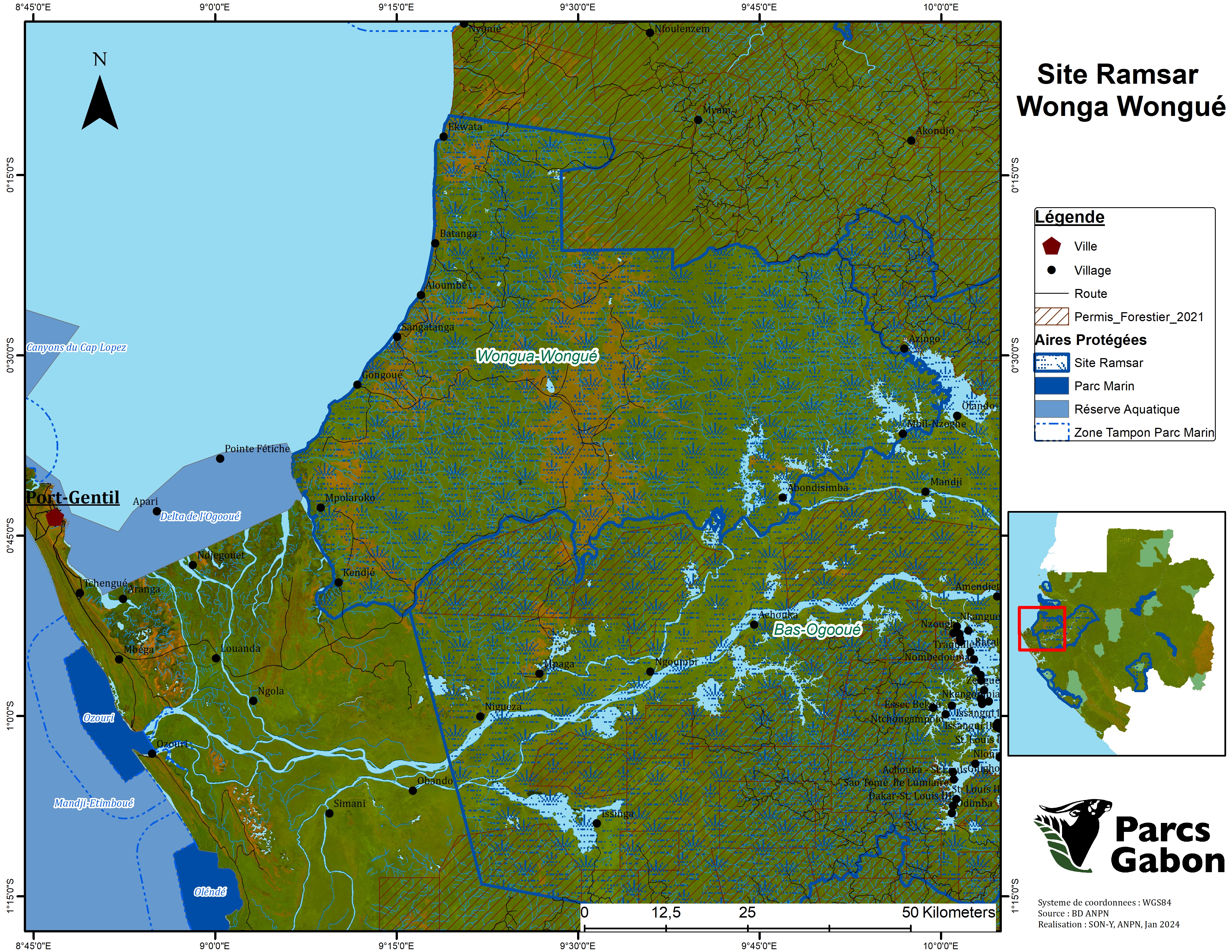
Wonga-Wongué
Wonga-Wongué
- Country:
- Gabon
- Site number:
- 351
- Area:
- 396,581.6 ha
- Designation date:
- 30-12-1986
- Coordinates:
- 00°32'11"S 09°30'54"E
Carousel
Carousel


Materials presented on this website, particularly maps and territorial information, are as-is and as-available based on available data and do not imply the expression of any opinion whatsoever on the part of the Secretariat of the Ramsar Convention concerning the legal status of any country, territory, city or area, or of its authorities, or concerning the delimitation of its frontiers or boundaries.
The Site (also known as Wongha-Wonghé) is an extensive coastal region in western Gabon composed of plains, rolling hills and plateaus dissected by numerous small coastal rivers, swamps and marshes. The coastal geology of sands, clays and soft sandstones has led to the creation through erosion of impressive amphitheatres and cliffs. The Site’s forest-savannah mosaics, humid tropical forests and alluvial basins are feeding grounds for large mammals, notably elephants, buffalo and hippopotamus, as well as chimpanzees and gorillas. The Site also supports threatened turtle species such as leatherback (Dermochelys coriacea), hawksbill (Eretmochelys imbricata) and green turtles (Chelonia mydas). The Site supports important numbers of waterbirds, with the great white pelican (Pelecanus onocrotalus) dominating. Any land use is controlled due to the Site’s status as a presidential reserve, giving it a very important conservation potential. There is logging in the surrounding areas, but this does not constitute a threat to the Site as yet. Tourism also occurs in the surroundings, with the main activities consisting of wildlife viewing and beach recreation.
- hunting area
- presidential reserve
- GA351RIS_2412_fr.pdf
- GA351RISformer1997.pdf
- GA351RISformer1993.pdf
- GA351RISformer_160316.pdf
- GA351RISformer_240116_1611_fr.pdf
- GA351_map1606.pdf
- GA351_map240328.jpg