


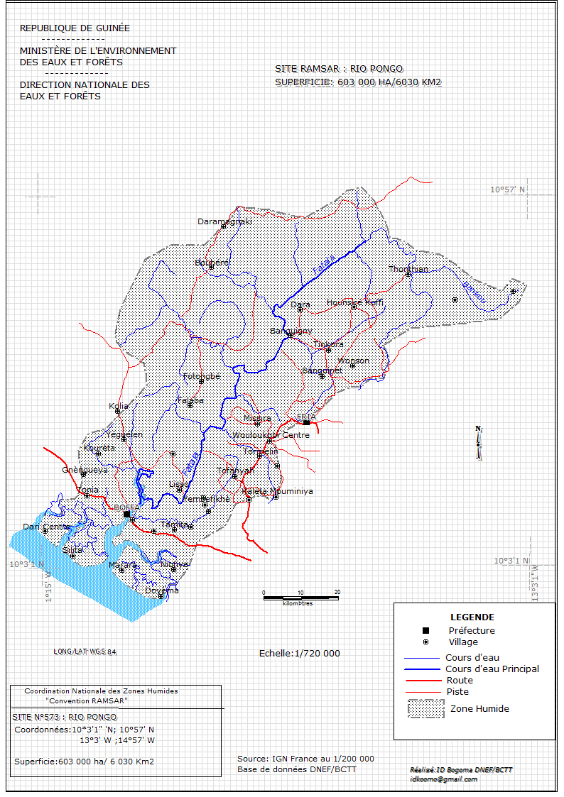
Rio Pongo
- Country:Guinea
- Site number:574
- Area:600,571 ha
- Designation date:18-11-1992
- Coordinates:10°31'N 13°44'W
Materials presented on this website, particularly maps and territorial information, are as-is and as-available based on available data and do not imply the expression of any opinion whatsoever on the part of the Secretariat of the Ramsar Convention concerning the legal status of any country, territory, city or area, or of its authorities, or concerning the delimitation of its frontiers or boundaries.
Overview
Rio Pongo is an extensive estuarine complex dominated by pristine mangrove forests, with some intertidal mudflats. It is a resting, reproduction and growth area for juvenile waterbirds, and a migration corridor for many coastal and marine organisms. The mangrove ecosystem is a biodiversity hotspot. The site is home to bird species such as the woolly-necked stork (Ciconia episcopus), Goliath heron (Ardea goliath), hamerkop (Scopus umbretta), yellow-billed stork (Mycteria ibis) and osprey (Pandion haliaetus). The vulnerable African manatee (Trichechus senegalensis) has also been reported. Several small villages which depend on traditional fishing and subsistence rice growing are found on stabilized dune ridges within the Site. Other human activities include woodcutting by outsiders, poaching, and disturbance of nesting birds. Domestic and foreign artisanal fishermen are attracted by the abundance of fish resources along the Site’s seafront, as are illegal trawlers of industrial fisheries. Hunting, poaching, disturbance of possible nesting sites, the misuse of mangrove forests, and rice cultivation are also potential threats to the Site.
Administrative region:
Boké
- Last publication date:28-03-2017
Downloads
Ramsar Information Sheet (RIS)
Archived RIS
Site map
Additional reports and documents
- Other published literature