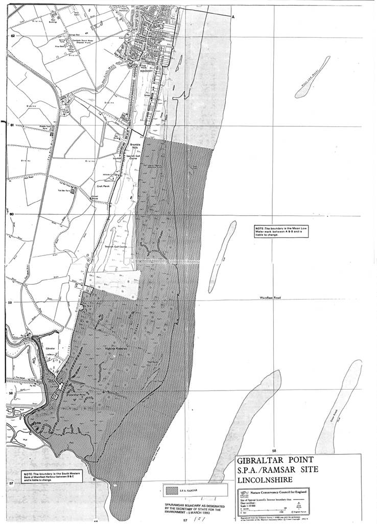
Gibraltar Point
- Country:United Kingdom of Great Britain and Northern Ireland
- Site number:589
- Area:414 ha
- Designation date:05-03-1993
- Coordinates:53°06'N 00°20'E
Materials presented on this website, particularly maps and territorial information, are as-is and as-available based on available data and do not imply the expression of any opinion whatsoever on the part of the Secretariat of the Ramsar Convention concerning the legal status of any country, territory, city or area, or of its authorities, or concerning the delimitation of its frontiers or boundaries.
Overview
Gibraltar Point. 05/03/93; England; 414 ha; 53°06'N 000°20'E. National Nature Reserve, Special Protection Area EC Directive, SSSI. The area consists of a sand dunes system, freshwater and saltmarsh, extensive intertidal flats, and open water. The vegetation includes sedges (Carex spp), rushes, ferns, crowfoot, reed, sea holly, and sea campion. It supports Pluvialis squatarola (1.2% of the population), Limosa lapponica (0.6% of the population), and Branta bernicla bernicla (0.3% of the population). The site is used for recreation and grazing. Ramsar site no. 589. Most recent RIS information: 1999.
Administrative region:
England
- National legal designation:
- asp
- lnr
- ncr
- nnr
- sssi
- Regional (international) legal designations:
- EU Natura 2000
- Last publication date:01-01-1999