Latorica
Latorica
- Country:
- Slovakia
- Site number:
- 606
- Area:
- 4,405.0 ha
- Designation date:
- 26-05-1993
- Coordinates:
- 48°29'25"N 22°01'23"E
Carousel
Carousel


Materials presented on this website, particularly maps and territorial information, are as-is and as-available based on available data and do not imply the expression of any opinion whatsoever on the part of the Secretariat of the Ramsar Convention concerning the legal status of any country, territory, city or area, or of its authorities, or concerning the delimitation of its frontiers or boundaries.
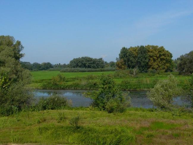
Latorica. 26/05/93; Trebisov; 4,405 ha; 48°29'N 022°04'E. Landscape Protection Area, Nature Reserve. The widest part of the Latorica River, including a well-developed network of oxbow lakes, tributaries, seasonal pools, reedbeds, marshes, wet meadows, pasture and floodplain forest. The site borders Ukraine. The area supports a rich wetland fauna of dragonflies (Odonata), amphibians, and nesting waterbirds. Human activities include fishing, hunting, forestry, livestock grazing, and haymaking. Area extended in 2003. Ramsar site no. 606. Most recent RIS information: 2006.
Administrative region:
Kosice
National legal designation:
- National Nature Reserve nnr
- Regional Territorial System of Ecological Stability R-TSES
- nature reserve
- protected landscape area
Last publication date:
01-01-2006
Ramsar Information Sheet (RIS)
- SK606RIS.pdf
- SK606RISformer2002_EN.pdf
- SK606map.pdf
Archived RIS
Site map
Additional reports and documents
Taxonomic lists of plant and animal species occurring in the site