Humedal Manchón-Guamuchal
Humedal Manchón-Guamuchal
- Country:
- Guatemala
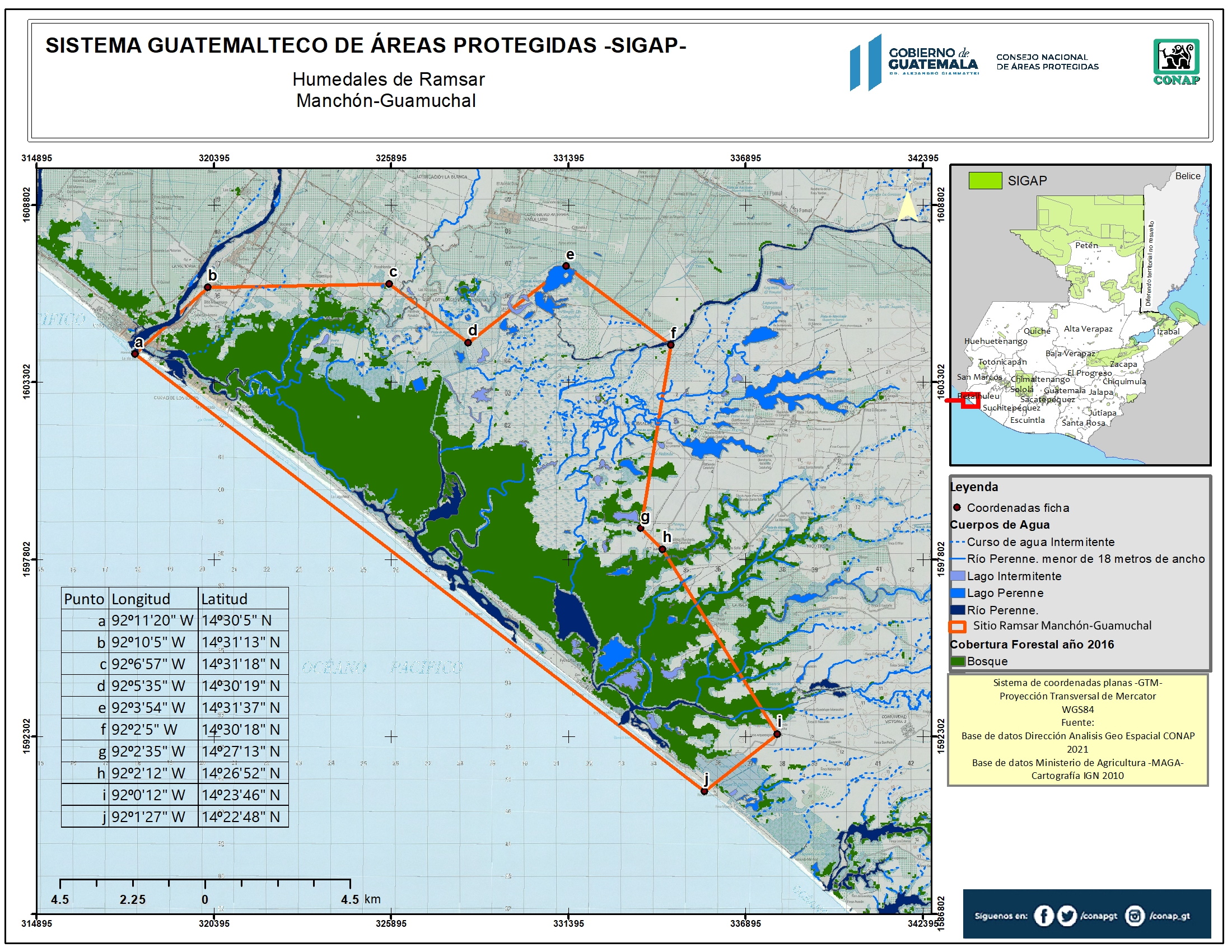
- Site number:
- 725
- Area:
- 14,219.7 ha
- Designation date:
- 25-04-1995
- Coordinates:
- 14°28'03"N 92°05'12"W
Carousel
Carousel


Materials presented on this website, particularly maps and territorial information, are as-is and as-available based on available data and do not imply the expression of any opinion whatsoever on the part of the Secretariat of the Ramsar Convention concerning the legal status of any country, territory, city or area, or of its authorities, or concerning the delimitation of its frontiers or boundaries.
In 2022 Guatemala updated this Site, amending its official area from 13,500 to 14,219 hectares. It is characterized by a combination of different plant communities including coastal dune flora, dry forest, mangrove forest, palm forest and freshwater marsh. The Site hosts rare and threatened species such as American crocodile (Crocodylus acutus) and leatherback and olive ridley sea turtles (Dermochelys coriacea and Lepidochelys olivacea). The wetland may be the only remaining site in Guatemala for migrating birds using the western flyway corridor. The Site possess the largest mangrove cover in Guatemala and hosts the greatest diversity of waterbirds in the country. Human activities inside the Site include shrimp farming, ranching, and cattle grazing. The main threats to the Site are the discharge of waste and toxic substances from agriculture and agroindustry in the upper parts of the watershed, and the over-exploitation of mangroves.
- Área de Protección Especial
- Área protegida privada
- GT725RIS_2303_es.pdf
- GT725RISformer1993_EN.pdf
- GT725RISformer_160210.pdf
- GT725_map221125.jpg