Okavango Delta System
Okavango Delta System
- Country:
- Botswana
- Site number:
- 879
- Area:
- 5,537,400.0 ha
- Designation date:
- 09-12-1996
- Coordinates:
- 19°17'24"S 22°54'58"E
Carousel
Carousel


Materials presented on this website, particularly maps and territorial information, are as-is and as-available based on available data and do not imply the expression of any opinion whatsoever on the part of the Secretariat of the Ramsar Convention concerning the legal status of any country, territory, city or area, or of its authorities, or concerning the delimitation of its frontiers or boundaries.
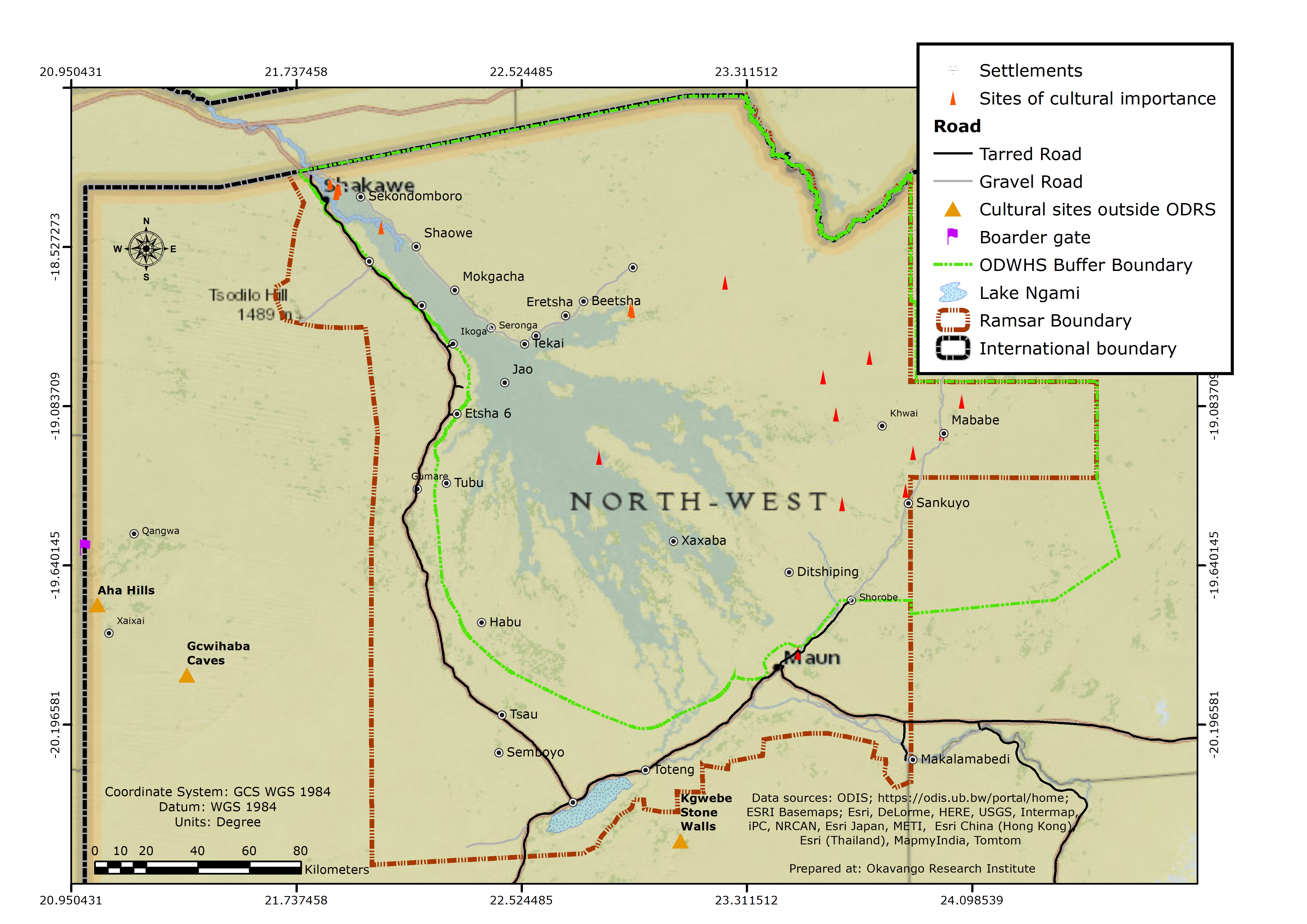
The Site, which reaches the border with Namibia, covers the Botswanan part of the Okavango delta system. The Site covers the Okavango River, the Kwando/Linyanti river system that connects to the Okavango through the Selinda spillway, and the intervening and surrounding land areas. This normally semi-arid area is subject to extensive seasonal floods with large fluctuations in flooded area from year to year. The Site accordingly features permanent and seasonal swamps, floodplains and a seasonal freshwater lake. The floodplains form critical habitat for many species of birds and other wildlife. The plant life includes over 1,060 species, with most vegetation communities consisting of sedges, grasses and aquatic plants. Woody species are restricted to the higher areas which remain as islands during the flooding. The animal life is diverse and includes 32 large mammal species, over 650 species of birds, 68 species of fish, and a highly diverse insect population. The Site is used for recreation, tourism, subsistence farming and fishing. The Okavango delta system is jointly managed through the Okavango Delta Management Plan and the Permanent Okavango River Basin Commission (OKACOM), a tri-partite agreement between Botswana, Namibia and Angola to promote the sustainable management and conservation of the entire water basin.
- World Heritage site
- Wildlife Management Areas - the Kwando and the Okavango Wildlife Management Areas
- game Reserve - The Moremi Game Reserve
- Other international designation
- BW879RIS_2103_en.pdf
- BW879RISformer.pdf
- BW879RISformer_180403.pdf
- BW879map.zip
- BW879map22007.pdf
- BW879_map210227.jpg
- BW879mgt.pdf
- BW879_mgt201012.doc