Resultados de la búsqueda
La búsqueda encontró 540 sitios Ramsar que abarcan 48,104,932 ha
- (-) Remove Amenazas: Especies invasoras y otras especies y genes problemáticos filter Amenazas: Especies invasoras y otras especies y genes problemáticos
- (-) Remove Amenazas: Regulación del agua filter Amenazas: Regulación del agua
Mapa
Los materiales presentados en este sitio web, particularmente los mapas y la información territorial, se proporcionan tal cual y según están disponibles a partir de los datos de los que se dispone y no implican la expresión de opinión alguna por parte de la Secretaría de la Convención de Ramsar respecto de la condición jurídica de ningún país, territorio, ciudad o zona, ni de sus autoridades, ni respecto de la delimitación de sus límites o fronteras.
Lista
-

Patvinsuo National Park
-
País:Finlandia
-
Fecha de designación:28-05-1974
-
Número del sitio:10
-
Publicado hace:3 year(s)
12,727 ha -
-


Ånnsjön
-
País:Suecia
-
Fecha de designación:05-12-1974
-
Número del sitio:26
-
Publicado hace:7 year(s)
11,031 ha -
-


Ölands ostkust
-
País:Suecia
-
Fecha de designación:05-12-1974
-
Número del sitio:18
-
Publicado hace:5 year(s)
10,718 ha -
-


Amirkelayeh Lake
-
País:Irán (República Islámica del)
-
Fecha de designación:23-06-1975
-
Número del sitio:47
-
Publicado hace:1 year(s)
1,132 ha -
-
 and reed bed of Chokum Wildlife Refuge are seen. The building with red roof is Anzali Wetland Eco Tourism Center.")

 in the north of Anzali Wetland.")


 nests on the submerged aquatic plant in west lagoon of Anzali Wetland")
 nests on Water chestnuts leaves in Sorkhankol Wildlife Refuge")
 and Common Tern (Sterna hirundo) in West Lagoon")

 in Selke Wildlife Refuge. Hundreds of PS can be sometimes seen in front of reedbed in Anzali Wetland.")
 in West Lagoon. The biomass of the flog is very huge in the site which provides food s for other animals.")

Anzali Wetland
-
País:Irán (República Islámica del)
-
Fecha de designación:23-06-1975
-
Número del sitio:40
-
Publicado hace:1 year(s)
19,500 ha -
-

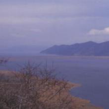


Lake Mikri Prespa
-
País:Grecia
-
Fecha de designación:21-08-1975
-
Número del sitio:60
-
Publicado hace:26 year(s)
5,078 ha -
-

Srébarna
-
País:Bulgaria
-
Fecha de designación:24-09-1975
-
Número del sitio:64
-
Publicado hace:11 year(s)
1,464 ha -
-


Ropotamo Complex
-
País:Bulgaria
-
Fecha de designación:24-09-1975
-
Número del sitio:65
-
Publicado hace:4 year(s)
3,385 ha -
-
 et le Fanel (à droit du canal) avec les zones humides et la lagune.")
 .")
Fanel et Chablais de Cudrefin
-
País:Suiza
-
Fecha de designación:16-01-1976
-
Número del sitio:79
-
Publicado hace:7 year(s)
1,155 ha -
-


Lake Ammer
-
País:Alemania
-
Fecha de designación:26-02-1976
-
Número del sitio:93
-
Publicado hace:0 year(s)
6,386 ha -