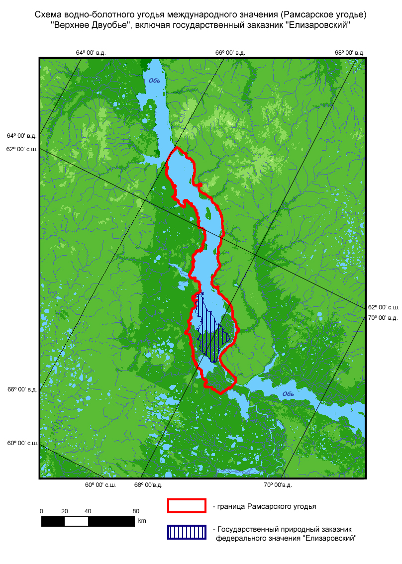
Upper Dvuobje
Upper Dvuobje
- País:
- Federación de Rusia
- Número del sitio:
- 678
- Superficie:
- 470,000.0 ha
- Fecha de designación:
- 13-09-1994
- Coordenadas:
- 61°42'N 67°10'E
Los materiales presentados en este sitio web, particularmente los mapas y la información territorial, se proporcionan tal cual y según están disponibles a partir de los datos de los que se dispone y no implican la expresión de opinión alguna por parte de la Secretaría de la Convención de Ramsar respecto de la condición jurídica de ningún país, territorio, ciudad o zona, ni de sus autoridades, ni respecto de la delimitación de sus límites o fronteras.
An extensive network of the Ob River tributaries composed of permanent and seasonal lakes (sors), marshes, and islands supporting high taiga forests and meadows. These habitats interact, forming a complex and unique mosaic of terrestrial and aquatic habitats. The site and the adjacent Lower Dvuobje Ramsar site form one of the richest waterbird habitats and nesting areas in the world, supporting numerous species of nationally or globally threatened waterbirds. The area supports large breeding, molting and migrating populations of waterbirds. Estimated numbers of waterbirds migrating through the area in spring are 500,000 to 3,000,000 individuals, with various duck species being the most numerous. Breeding waterbirds reach 300,000 pairs. The site supports a rich mammal and fish fauna. Human activities include conservation education, fish production, waterbirds hunting, hay harvesting, and livestock grazing.
Región administrativa:
Khanty-Mansi Autonomous Region
Designación jurídica nacional:
- state nature zakaznik of federal level - Elizarovsky
Fecha de última publicación:
01-08-2008
Ficha Informativa de los Humedales de Ramsar (FIR)
- RU678_RIS170704.pdf
- RU678_RISformer170704.pdf
FIR archivada
Mapa del sitio