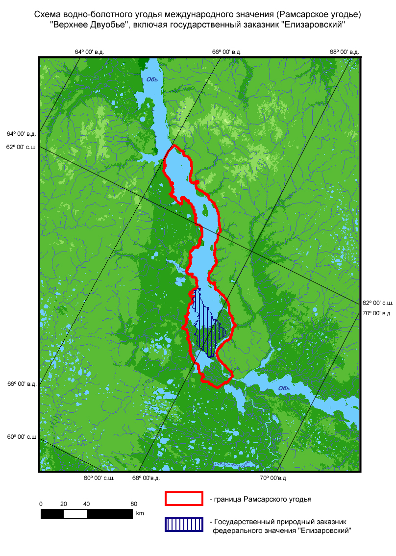
Upper Dvuobje
Upper Dvuobje
- Pays:
- Fédération de Russie
- Numéro du site:
- 678
- Superficie:
- 470,000.0 ha
- Date d'inscription:
- 13-09-1994
- Coordonnées:
- 61°42'N 67°10'E
Le matériel présenté sur ce site web, et en particulier les cartes et l’information territoriale, est tel qu’il apparaît dans les données disponibles et n’implique en aucune manière l’expression d’une opinion quelconque de la part du Secrétariat de la Convention de Ramsar concernant le statut juridique de tout pays, territoire, ville ou zone, ou de ses autorités, ou concernant la délimitation de ses frontières ou limites.
An extensive network of the Ob River tributaries composed of permanent and seasonal lakes (sors), marshes, and islands supporting high taiga forests and meadows. These habitats interact, forming a complex and unique mosaic of terrestrial and aquatic habitats. The site and the adjacent Lower Dvuobje Ramsar site form one of the richest waterbird habitats and nesting areas in the world, supporting numerous species of nationally or globally threatened waterbirds. The area supports large breeding, molting and migrating populations of waterbirds. Estimated numbers of waterbirds migrating through the area in spring are 500,000 to 3,000,000 individuals, with various duck species being the most numerous. Breeding waterbirds reach 300,000 pairs. The site supports a rich mammal and fish fauna. Human activities include conservation education, fish production, waterbirds hunting, hay harvesting, and livestock grazing.
Région administrative:
Khanty-Mansi Autonomous Region
Inscription légale nationale:
- state nature zakaznik of federal level - Elizarovsky
Date de dernière publication:
01-08-2008
Fiche descriptive Ramsar (FDR)
- RU678_RIS170704.pdf
FDR archivées