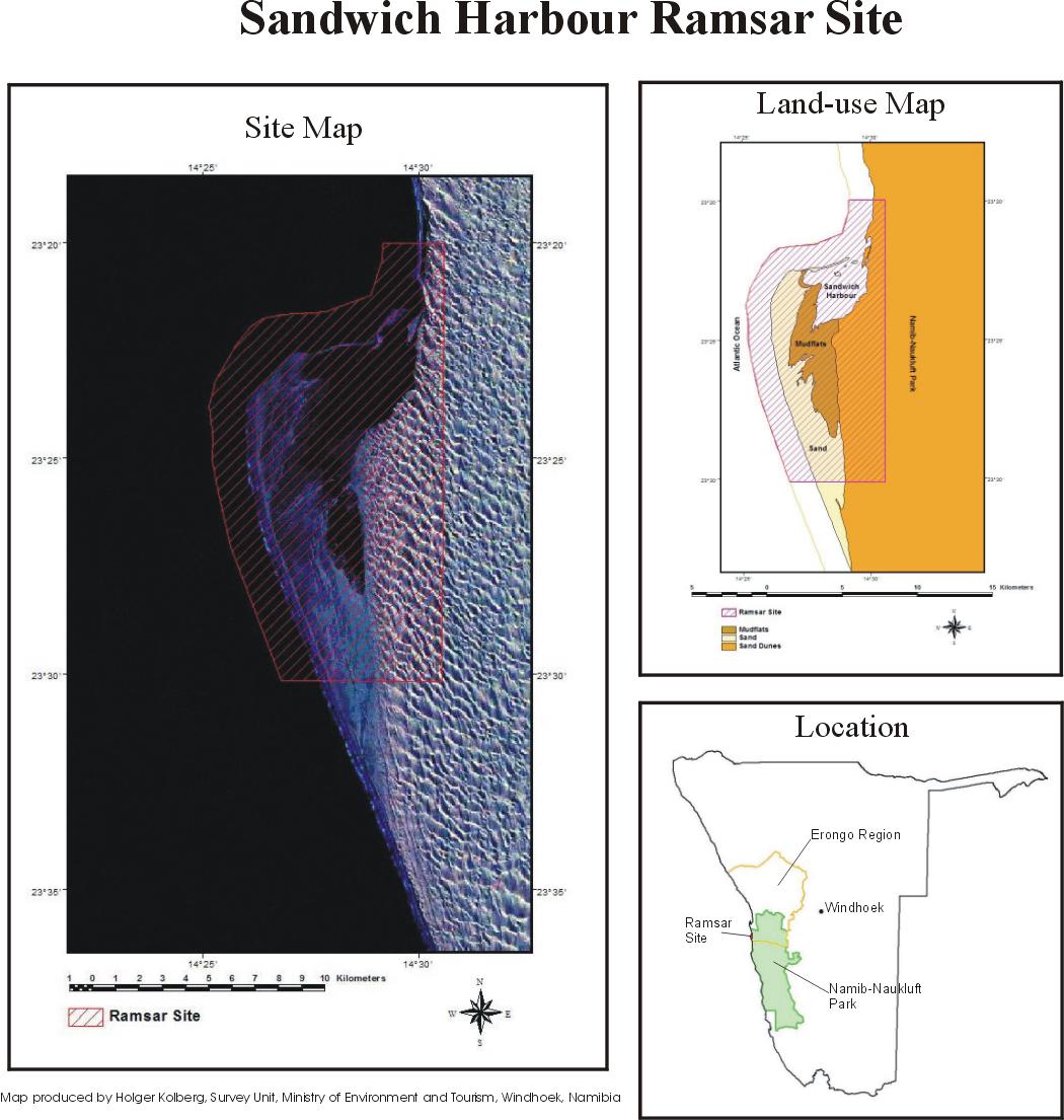
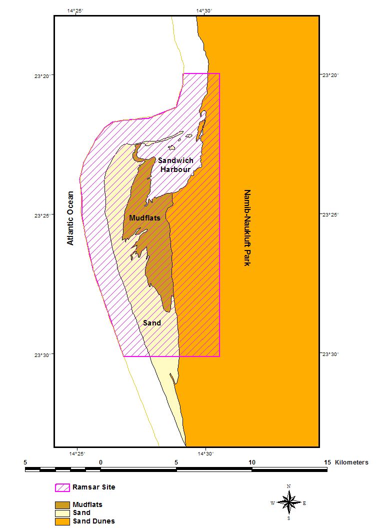
Sandwich Harbour
Sandwich Harbour
- País:
- Namibia
- Número del sitio:
- 743
- Superficie:
- 16,500.0 ha
- Fecha de designación:
- 23-08-1995
- Coordenadas:
- 23°22'59"S 14°28'59"E
Carousel
Carousel


Los materiales presentados en este sitio web, particularmente los mapas y la información territorial, se proporcionan tal cual y según están disponibles a partir de los datos de los que se dispone y no implican la expresión de opinión alguna por parte de la Secretaría de la Convención de Ramsar respecto de la condición jurídica de ningún país, territorio, ciudad o zona, ni de sus autoridades, ni respecto de la delimitación de sus límites o fronteras.
Sandwich Harbour. 23/08/95; 16,500 ha; 23°23'S 014°29'E. Namib-Naukluft Park, Marine Protected Area. Two distinct wetlands and associated mudflats. One is aquifer-fed and supports typical emergent vegetation, but is slowly disappearing due to natural causes. The second, under tidal influence, consists of mudflats and raised shingle bars. One of Namibia's most important coastal wetlands, supporting eight endangered species among the large numbers of wading birds. Several archaeological sites dating back 1,000 years exist within the site. Human activities have included fishing, guano collection, and hunting. The site is used for scientific research, with surrounding areas used for tourism, recreation, and angling. Ramsar site no. 743. Most recent RIS information: 1995.
Región administrativa:
Erongo Region
Designación jurídica nacional:
- national park - Namib Naukluft Park
Fecha de última publicación:
23-08-1995
Ficha Informativa de los Humedales de Ramsar (FIR)