Sandwich Harbour
Sandwich Harbour
- Pays:
- Namibie
- Numéro du site:
- 743
- Superficie:
- 16,500.0 ha
- Date d'inscription:
- 23-08-1995
- Coordonnées:
- 23°22'59"S 14°28'59"E
Carousel
Carousel


Le matériel présenté sur ce site web, et en particulier les cartes et l’information territoriale, est tel qu’il apparaît dans les données disponibles et n’implique en aucune manière l’expression d’une opinion quelconque de la part du Secrétariat de la Convention de Ramsar concernant le statut juridique de tout pays, territoire, ville ou zone, ou de ses autorités, ou concernant la délimitation de ses frontières ou limites.
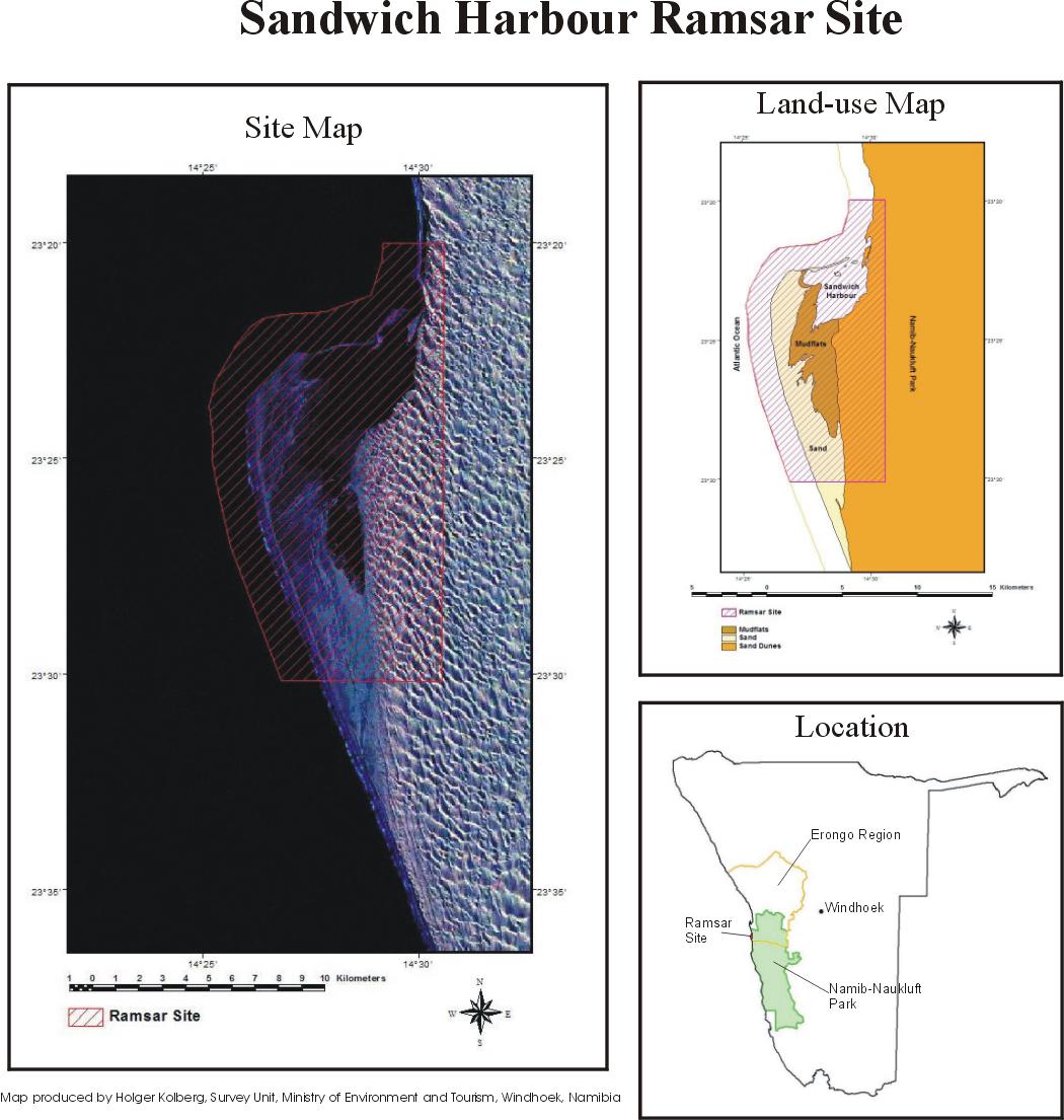
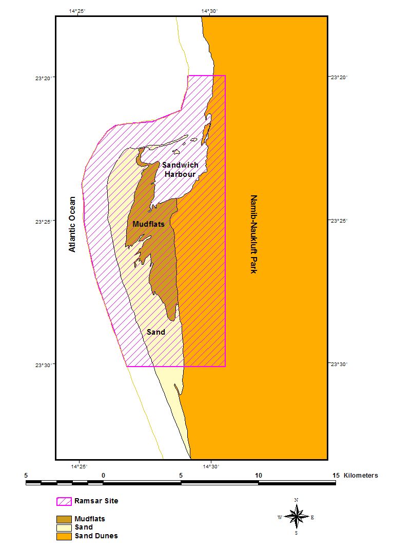
Sandwich Harbour. 23/08/95; 16,500 ha; 23°23'S 014°29'E. Namib-Naukluft Park, Marine Protected Area. Two distinct wetlands and associated mudflats. One is aquifer-fed and supports typical emergent vegetation, but is slowly disappearing due to natural causes. The second, under tidal influence, consists of mudflats and raised shingle bars. One of Namibia's most important coastal wetlands, supporting eight endangered species among the large numbers of wading birds. Several archaeological sites dating back 1,000 years exist within the site. Human activities have included fishing, guano collection, and hunting. The site is used for scientific research, with surrounding areas used for tourism, recreation, and angling. Ramsar site no. 743. Most recent RIS information: 1995.
Région administrative:
Erongo Region
Inscription légale nationale:
- national park - Namib Naukluft Park
Date de dernière publication:
23-08-1995
Fiche descriptive Ramsar (FDR)