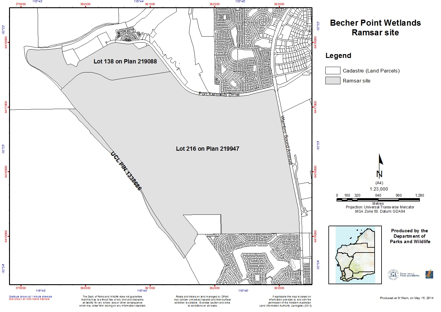
Becher Point Wetlands
Becher Point Wetlands
- Pays:
- Australie
- Numéro du site:
- 1048
- Superficie:
- 708.0 ha
- Date d'inscription:
- 05-01-2001
- Coordonnées:
- 32°22'57"S 115°44'24"E
Carousel
Carousel")
 at Becher Point (photo by Bronwyn Goody)")
")
")
Le matériel présenté sur ce site web, et en particulier les cartes et l’information territoriale, est tel qu’il apparaît dans les données disponibles et n’implique en aucune manière l’expression d’une opinion quelconque de la part du Secrétariat de la Convention de Ramsar concernant le statut juridique de tout pays, territoire, ville ou zone, ou de ses autorités, ou concernant la délimitation de ses frontières ou limites.
Le Site se compose d’une série de dunes et de dépressions humides. Dans ces dépressions se trouvent de petits marais parallèles à la côte. La séquence de dépressions interdunaires résulte de l’avancée du trait de côte vers la mer au cours des derniers millénaires. La série de zones humides du site présente un continuum de développement géomorphologique, hydrologique et végétal et est considérée comme un système de zones humides unique en Australie-Occidentale, et l’un des plus jeunes systèmes de zones humides de la plaine côtière de Swan. Les jonchaies du Site figurent sur la liste nationale des communautés écologiques menacées. Les espèces indigènes de cette communauté comprennent Acacia rostellifera et Lepidosperma gladiatum. Parmi les autres espèces présentes sur le Site figurent le bandicoot obèse (Isoodon obesulus) et le scinque de Perth (Lerista lineata).
- Nature Reserve - Crown Reserve 44077
- AU1048RIS_2503_en.pdf
- AU1048RISformer_160315.pdf
- AU1048RISformer_230209_1409_en.pdf
- AU1048_map1603.jpg
- AU1048_mgt1603.pdf