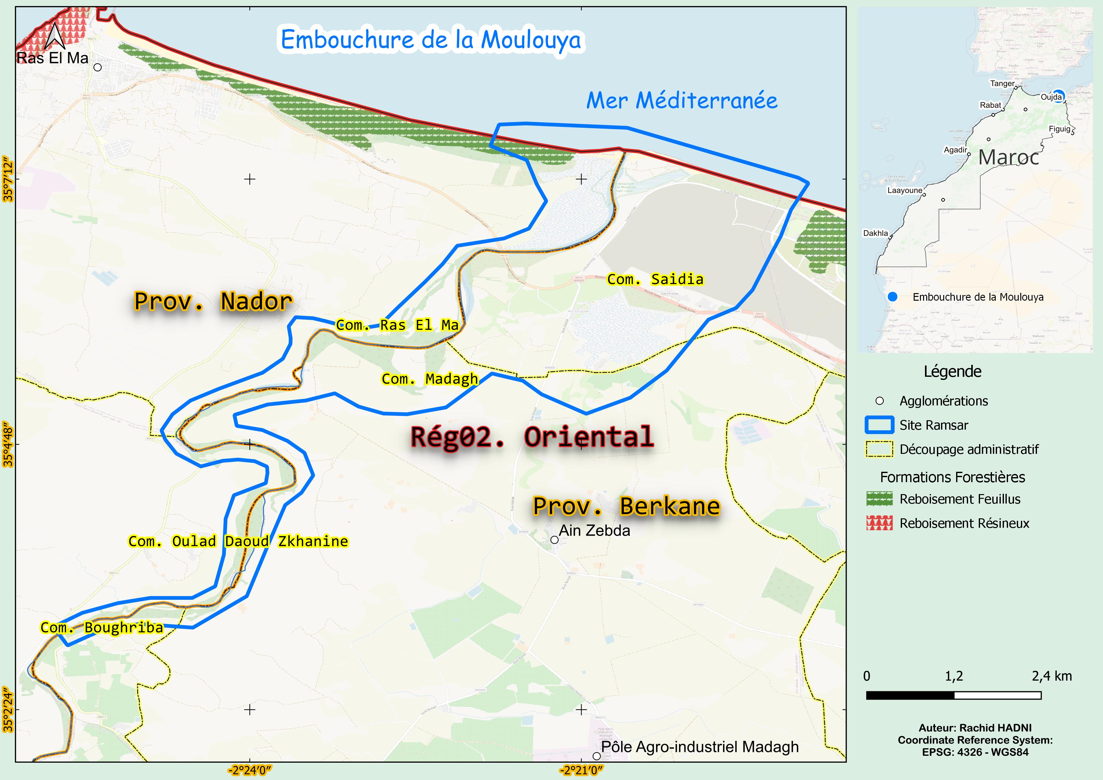
Embouchure de la Moulouya
Embouchure de la Moulouya
- Pays:
- Maroc
- Numéro du site:
- 1478
- Superficie:
- 2,340.0 ha
- Date d'inscription:
- 15-01-2005
- Coordonnées:
- 35°05'55"N 02°21'41"W
Carousel
Carousel


Le matériel présenté sur ce site web, et en particulier les cartes et l’information territoriale, est tel qu’il apparaît dans les données disponibles et n’implique en aucune manière l’expression d’une opinion quelconque de la part du Secrétariat de la Convention de Ramsar concernant le statut juridique de tout pays, territoire, ville ou zone, ou de ses autorités, ou concernant la délimitation de ses frontières ou limites.
Le Site comprend l’estuaire et la plaine d’inondation du plus grand fleuve méditerranéen du Maghreb. Il présente divers habitats, notamment des systèmes estuariens, marins, lacustres, fluviaux et palustres, ainsi qu’un cordon dunaire côtier. Il s’agit d’une halte cruciale pour les oiseaux migrateurs qui traversent les paysages arides de la région, offrant un refuge dans sa végétation dominée par les tamaris. Son paysage comprend six à sept kilomètres de chenal fluvial bordé de forêts alluviales à Tamarix, de marais salés semi-temporaires et d’une bande de milieu marin s’étendant sur 6 km vers le large. Les espèces clés comprennent le rougequeue de Moussier (Phoenicurus moussieri), la marmaronette marbrée (Marmaronetta angustirostris), et le goéland d’Audouin (Ichthyaetus audouinii). Les zones humides abritent également des espèces de poissons rares et endémiques, qui utilisent l’estuaire comme frayère et nurserie lors des migrations saisonnières. L’estuaire régule la dynamique de l’eau en stockant les eaux de crue, ce qui contribue à réduire la salinité des eaux souterraines. Toutefois, son hydrologie a changé de manière significative en raison des inondations extrêmes survenues au cours du siècle dernier. Un complexe aquacole aujourd’hui abandonné fait également partie du Site. Il s’agit d’un Site très prometteur pour l’écotourisme et les efforts de conservation. Malgré sa grande valeur écologique et esthétique, il subit des pressions telles que la dégradation des habitats causée par l’extraction de sable et de gravier, la conversion des zones humides et la baisse de la qualité de l’eau due au ruissellement agricole, au dépôt de déchets et à la réduction des débits de crue.
- MA1478RIS_2503_fr.pdf
- MA1478RISformer_180418.pdf
- MA1478_map230720.jpg
- MA1478_taxo161006.docx
- MA1478_lit161006.docx
- Site boundaries (GIS file)