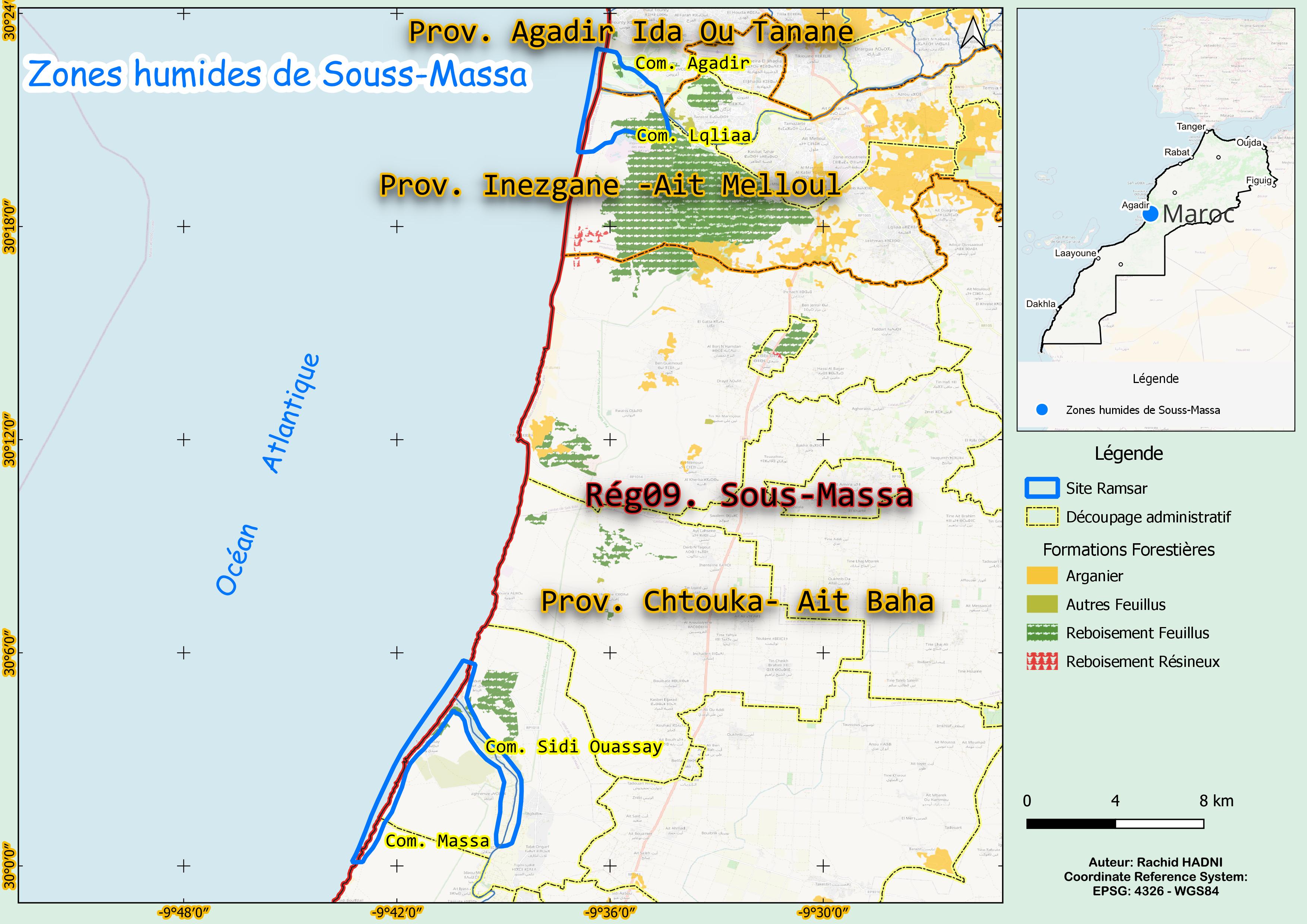
Zones humides de Souss-Massa
Zones humides de Souss-Massa
- Pays:
- Maroc
- Numéro du site:
- 1487
- Superficie:
- 2,830.0 ha
- Date d'inscription:
- 15-01-2005
- Coordonnées:
- 30°11'35"N 09°38'16"W
Carousel
Carousel


Le matériel présenté sur ce site web, et en particulier les cartes et l’information territoriale, est tel qu’il apparaît dans les données disponibles et n’implique en aucune manière l’expression d’une opinion quelconque de la part du Secrétariat de la Convention de Ramsar concernant le statut juridique de tout pays, territoire, ville ou zone, ou de ses autorités, ou concernant la délimitation de ses frontières ou limites.
Ce complexe de zones humides situé dans le parc national de Souss-Massa se compose de deux zones distinctes présentant des habitats diversifiés, notamment des dunes, des marais d’eau douce et saumâtre, des eaux côtières, des plages de sable et des rivages rocheux. Le Site est également inscrit comme réserve de chasse permanente. Identifié à l’origine pour protéger l’ibis chauve (Geronticus eremita), une espèce en danger dont 7 % de la population biogéographique est présente, le Site a depuis été reconnu comme un refuge important pour plus de 270 espèces d’oiseaux, dont la marmaronette marbrée (Marmaronetta angustirostris). L’agriculture domine le paysage, en particulier les bananeraies et l’élevage, tandis que l’écotourisme et le tourisme côtier sont également importants. Cependant, la pollution urbaine et les perturbations causées par la population locale et les touristes menacent de plus en plus l’intégrité écologique de la zone humide.
- National Park - Parc National de Souss-Massa
- Permanent Hunting Reserve
- MA1487RIS_2503_fr.pdf
- MA1487RISformer_220830.pdf
- MA1487_map230807.jpg
- MA1487_taxo161004.docx