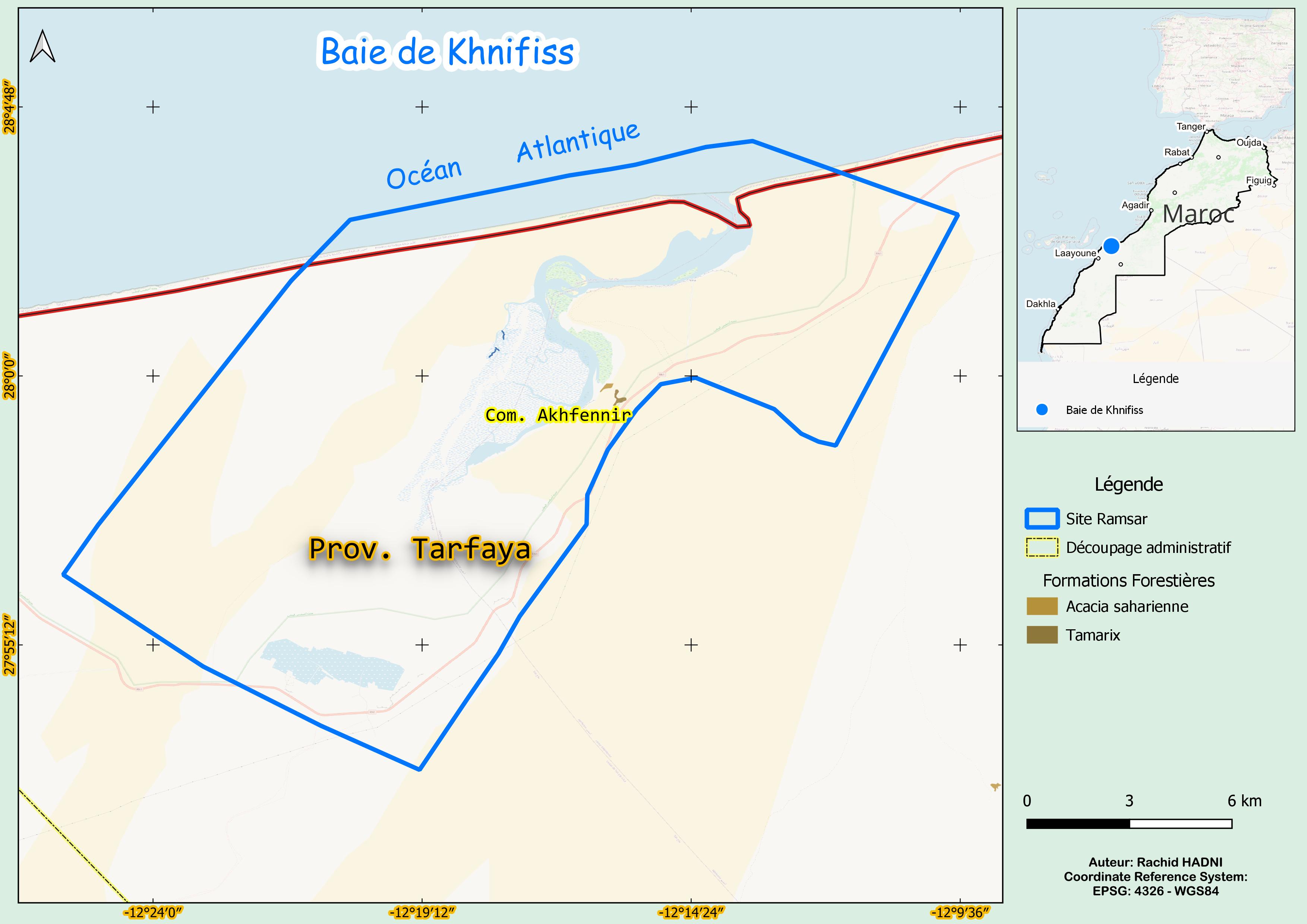
Baie de Khnifiss
Baie de Khnifiss
- Pays:
- Maroc
- Numéro du site:
- 209
- Superficie:
- 26,310.0 ha
- Date d'inscription:
- 20-06-1980
- Coordonnées:
- 27°59'17"N 12°18'05"W
Carousel
Carousel


Le matériel présenté sur ce site web, et en particulier les cartes et l’information territoriale, est tel qu’il apparaît dans les données disponibles et n’implique en aucune manière l’expression d’une opinion quelconque de la part du Secrétariat de la Convention de Ramsar concernant le statut juridique de tout pays, territoire, ville ou zone, ou de ses autorités, ou concernant la délimitation de ses frontières ou limites.
La Baie de Khnifiss est un système complexe d’habitats interconnectés, comprenant la lagune de Khnifiss, les sebkhas (étendues salées) de Tazra et Mzeira, un grand lac saisonnier (daya La'wina), bordé de falaises et de dunes de sable abruptes, le lit de l’oued Awedri, normalement asséché, et le littoral marin adjacent. Les formations dunaires bloquent parfois l’écoulement de l’eau, ce qui rend les brèches rares. La lagune est très productive grâce aux remontées d’eau océanique, et abrite une flore et une faune diversifiées, dont la marmaronette marbrée (Marmaronetta angustirostris), vulnérable à l’échelle mondiale. Elle constitue également un habitat pour des oiseaux d’eau tels que le bécasseau maubèche (Calidris alba) et la barge rousse (Limosa lapponica). Le Site est une halte vitale pour les oiseaux migrateurs le long de la voie de migration Est-Atlantique. Malgré son importance écologique, la dégradation des habitats et les changements hydrologiques constituent des menaces croissantes. Le renforcement des efforts de conservation est essentiel pour préserver la biodiversité et soutenir les espèces migratrices.
- Site of Biological and Ecological Interest
- Zone d'Importance pour la Conservation des Oiseaux
- biological reserve
- MA209RIS_2503_fr.pdf
- MA209RISformer_FR.pdf
- MA209RISformer_EN.pdf
- MA209RISformer_160218.pdf
- MA209_map230807.jpg