Paysage Aquatique Protégé du Nord
Paysage Aquatique Protégé du Nord
- Pays:
- Burundi
- Numéro du site:
- 2149
- Superficie:
- 16,242.0 ha
- Date d'inscription:
- 14-03-2013
- Coordonnées:
- 02°30'S 30°09'20"E
Carousel
Carousel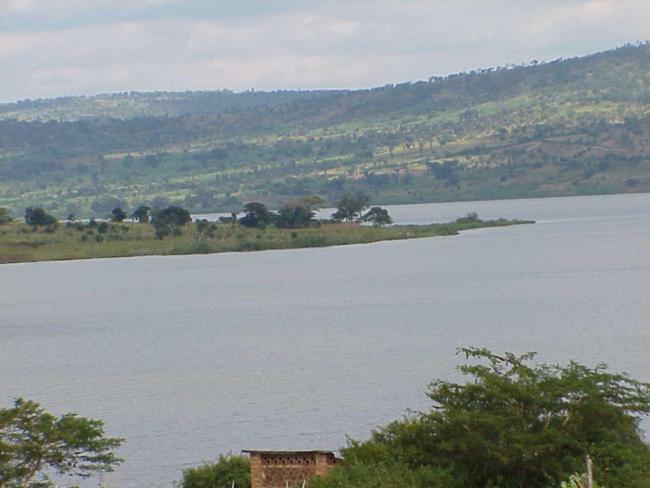
Le matériel présenté sur ce site web, et en particulier les cartes et l’information territoriale, est tel qu’il apparaît dans les données disponibles et n’implique en aucune manière l’expression d’une opinion quelconque de la part du Secrétariat de la Convention de Ramsar concernant le statut juridique de tout pays, territoire, ville ou zone, ou de ses autorités, ou concernant la délimitation de ses frontières ou limites.
Paysage Aquatique Protégé du Nord. 14/03/13; Kirundo; 16,242 ha; 02°30'00"S 030°09'20"E. Protected Landscape, including a nature reserve. This is a complex of 8 permanent freshwater lakes and marshes, forming part of the Nile basin. It is a biodiversity rich site supporting several IUCN Red Listed species including the endemic fish species Barbus acuticeps and Synodontis ruandae, the Madagascar Pond Heron Ardeola idea, and the endangered Grey Crowned-crane Balearica regulorum. Twenty fish species including two endemic species have been identified in the site. It is composed of Soudano-Zambezian vegetation type with Tragelaphus scriptus, Sylvicapra grimmia and Lepus whytei. The site is an important habitat for waterbirds and a stopover ground for several migratory birds - with 60 bird species identified in one of its rivers. The presence of these waterbirds (over 5,000 individuals counted) has encouraged ecotourism in the site. Its main hydrological functions include general hydrological balance and flood control. Agriculture and fishing are the main human activities. The site is generally threatened by overexploitation of natural resources and erosion. Ramsar Site no. 2149. Most recent RIS information: 2013.
Région administrative:
Kirundo
Inscription légale nationale:
- Nature Reserve - la réserve naturelle de Murehe
- Protected Landscape - Paysage protégé du nord
Date de dernière publication:
14-03-2013
Fiche descriptive Ramsar (FDR)
- BI2149RIS.pdf
- BI2149map.pdf
Carte du site
Rapports et documents complémentaires
Other published literature