Minsmere - Walberswick
Minsmere - Walberswick
- Pays:
- Royaume-Uni de Grande-Bretagne et d'Irlande du Nord
- Numéro du site:
- 75
- Superficie:
- 2,019.0 ha
- Date d'inscription:
- 05-01-1976
- Coordonnées:
- 52°17'10"N 01°37'05"E
Le matériel présenté sur ce site web, et en particulier les cartes et l’information territoriale, est tel qu’il apparaît dans les données disponibles et n’implique en aucune manière l’expression d’une opinion quelconque de la part du Secrétariat de la Convention de Ramsar concernant le statut juridique de tout pays, territoire, ville ou zone, ou de ses autorités, ou concernant la délimitation de ses frontières ou limites.
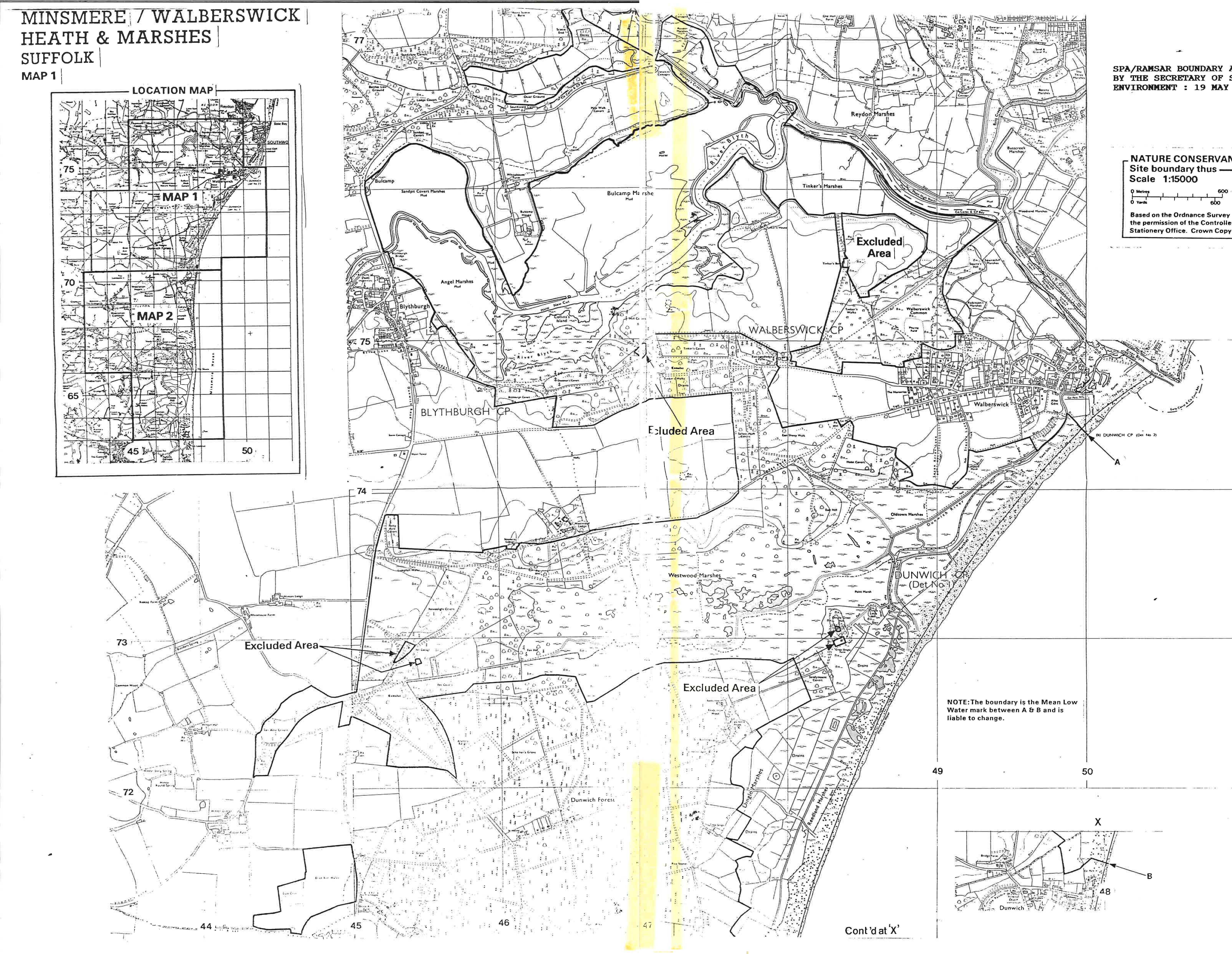
Minsmere-Walberswick. 05/01/76; England; 2,019 ha; 52°19'N 001°38'E. Special Protection Area EC Directive; Nature Reserve, SSSI, Environmentally Sensitive Area, Area of Outstanding Natural Beauty, Heritage Coast. A mosaic of coastal habitats consisting of shingle beaches, dunes, estuarine mudflats, grazing marshes, lagoons, reedbeds, and heathland. The marshes support the largest continuous stand of reedbed in England and Wales. The site supports an outstanding diversity of breeding birds, including a number of nationally rare species which winter at the site, as well as rare species of marshland flora and insect fauna. A flagship reserve, in which a well-developed system of trails and hides are maintained. Human activities include groundwater abstraction and increasing numbers of visitors. Ramsar site no. 75. Most recent RIS information: 1999.
Région administrative:
England
Inscription légale nationale:
- bird reserve
- nnr
- sssi
Regional (international) legal designations:
- UE Natura 2000
Date de dernière publication:
01-01-1999
Fiche descriptive Ramsar (FDR)
- GB75RIS.pdf
Carte du site