Minsmere - Walberswick
Minsmere - Walberswick
- Country:
- United Kingdom of Great Britain and Northern Ireland
- Site number:
- 75
- Area:
- 2,019.0 ha
- Designation date:
- 05-01-1976
- Coordinates:
- 52°17'10"N 01°37'05"E
Materials presented on this website, particularly maps and territorial information, are as-is and as-available based on available data and do not imply the expression of any opinion whatsoever on the part of the Secretariat of the Ramsar Convention concerning the legal status of any country, territory, city or area, or of its authorities, or concerning the delimitation of its frontiers or boundaries.
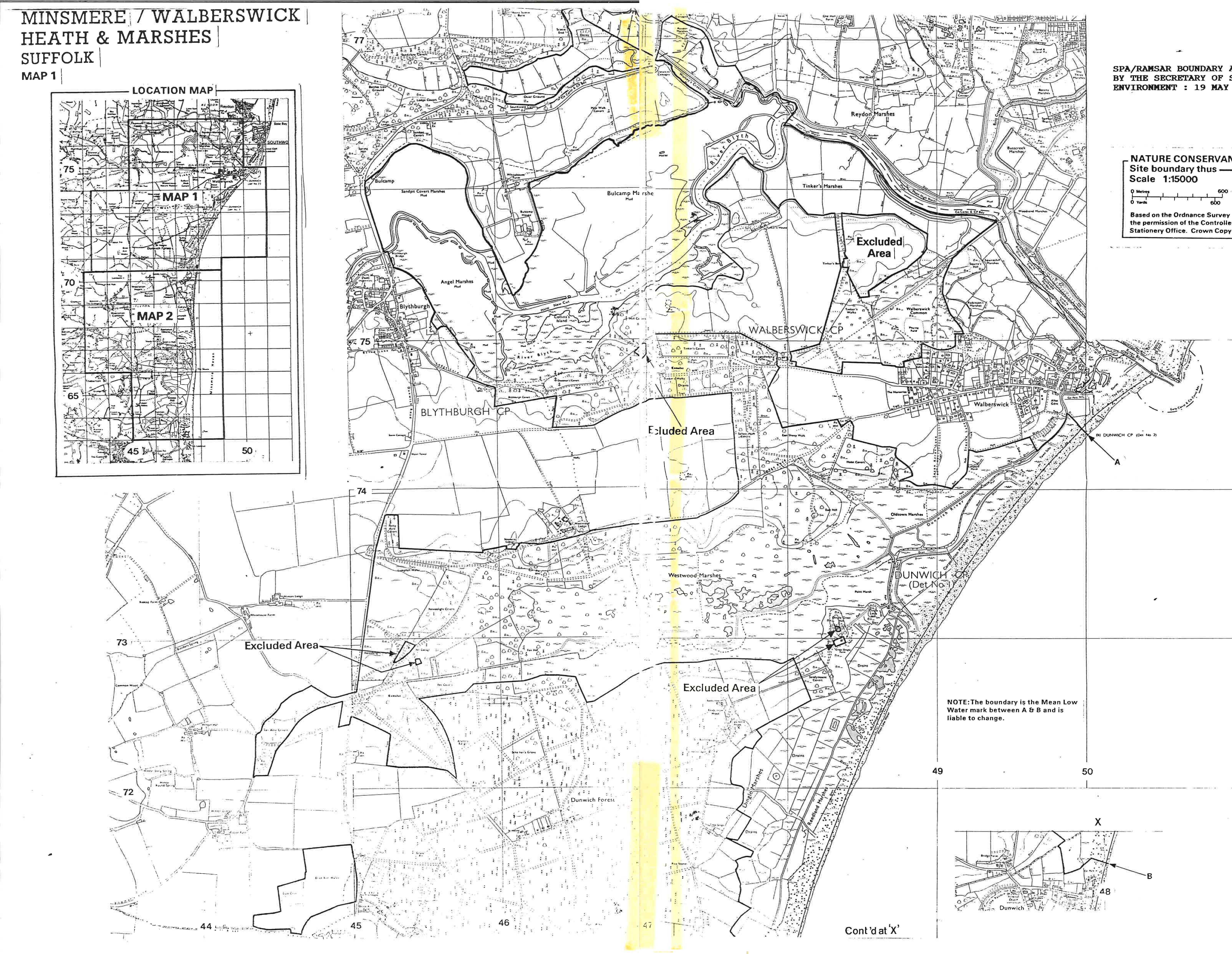
Minsmere-Walberswick. 05/01/76; England; 2,019 ha; 52°19'N 001°38'E. Special Protection Area EC Directive; Nature Reserve, SSSI, Environmentally Sensitive Area, Area of Outstanding Natural Beauty, Heritage Coast. A mosaic of coastal habitats consisting of shingle beaches, dunes, estuarine mudflats, grazing marshes, lagoons, reedbeds, and heathland. The marshes support the largest continuous stand of reedbed in England and Wales. The site supports an outstanding diversity of breeding birds, including a number of nationally rare species which winter at the site, as well as rare species of marshland flora and insect fauna. A flagship reserve, in which a well-developed system of trails and hides are maintained. Human activities include groundwater abstraction and increasing numbers of visitors. Ramsar site no. 75. Most recent RIS information: 1999.
Administrative region:
England
National legal designation:
- bird reserve
- nnr
- sssi
Regional (international) legal designations:
- EU Natura 2000
Last publication date:
01-01-1999
Ramsar Information Sheet (RIS)
- GB75RIS.pdf
Site map