Search results
Search found 63 Ramsar Sites covering 1,194,195 ha
- (-) Remove Region/country: Europe filter Region/country: Europe
- (-) Remove Region/country: Bangladesh filter Region/country: Bangladesh
- (-) Remove Region/country: Asia filter Region/country: Asia
- (-) Remove Region/country: Latvia filter Region/country: Latvia
- (-) Remove Region/country: Greece filter Region/country: Greece
- (-) Remove Region/country: Spain filter Region/country: Spain
- (-) Remove Region/country: Poland filter Region/country: Poland
- (-) Remove Region/country: Sweden filter Region/country: Sweden
- (-) Remove Region/country: Czech Republic filter Region/country: Czech Republic
- (-) Remove Threats: Transportation and service corridors filter Threats: Transportation and service corridors
- (-) Remove Region/country: Slovenia filter Region/country: Slovenia
Map
Materials presented on this website, particularly maps and territorial information, are as-is and as-available based on available data and do not imply the expression of any opinion whatsoever on the part of the Secretariat of the Ramsar Convention concerning the legal status of any country, territory, city or area, or of its authorities, or concerning the delimitation of its frontiers or boundaries.
List
-
 is crossing a tidal creek in Bangladesh Sundarbans")
 is feeding on its prey in the Mangrove Swamp of Bangladesh Sundarbans")

 of Bangladesh Sundarbans")
 from the Sundarbans")
 are being harvested by people as thatch materials for roofing village houses")
 being transported to the Khulna Newsprint Mill from the Sundarbans as a pulpwood for manufacturing newsprint.")

 in the Sundarbans of Bangladesh")

Sundarbans Reserved Forest
-
Country:Bangladesh
-
Designation date:21-05-1992
-
Site number:560
-
Published since:21 year(s)
601,700 ha -
-


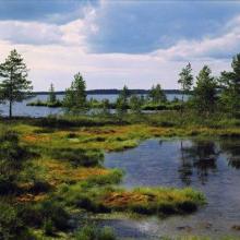
Sjaunja
-
Country:Sweden
-
Designation date:05-12-1974
-
Site number:32
-
Published since:7 year(s)
181,333 ha -
-


Vindelälven
-
Country:Sweden
-
Designation date:19-03-2013
-
Site number:2181
-
Published since:7 year(s)
66,395 ha -
-


Biebrzański National Park
-
Country:Poland
-
Designation date:24-10-1995
-
Site number:756
-
Published since:5 year(s)
59,233 ha -
-


Lubana wetland complex
-
Country:Latvia
-
Designation date:27-03-2003
-
Site number:1384
-
Published since:21 year(s)
48,020 ha -
-
")


")


L'Albufera
-
Country:Spain
-
Designation date:05-12-1989
-
Site number:454
-
Published since:3 year(s)
20,956 ha -
-


Lake Engure
-
Country:Latvia
-
Designation date:25-07-1995
-
Site number:738
-
Published since:0 year(s)
19,762 ha -
-

Åsnen
-
Country:Sweden
-
Designation date:12-06-1989
-
Site number:429
-
Published since:7 year(s)
17,866 ha -
-


Svenska Högarna-Nassa
-
Country:Sweden
-
Designation date:12-06-1989
-
Site number:435
-
Published since:7 year(s)
15,210 ha -
-


Wigry National Park
-
Country:Poland
-
Designation date:29-10-2002
-
Site number:1567
-
Published since:5 year(s)
15,085 ha -