Search results
Search found 138 Ramsar Sites covering 8,224,598 ha
- (-) Remove Region/country: Serbia filter Region/country: Serbia
- (-) Remove Region/country: Lithuania filter Region/country: Lithuania
- (-) Remove Region/country: Portugal filter Region/country: Portugal
- (-) Remove Management plan available: Yes filter Management plan available: Yes
- (-) Remove Region/country: Oceania filter Region/country: Oceania
- (-) Remove Region/country: North America filter Region/country: North America
- (-) Remove Region/country: Armenia filter Region/country: Armenia
- (-) Remove Threats: Pollution filter Threats: Pollution
- (-) Remove Region/country: Liechtenstein filter Region/country: Liechtenstein
- (-) Remove Statutory designation taxonomy: UNESCO Biosphere Reserve filter Statutory designation taxonomy: UNESCO Biosphere Reserve
Map
Materials presented on this website, particularly maps and territorial information, are as-is and as-available based on available data and do not imply the expression of any opinion whatsoever on the part of the Secretariat of the Ramsar Convention concerning the legal status of any country, territory, city or area, or of its authorities, or concerning the delimitation of its frontiers or boundaries.
List
-


Towra Point
-
Country:Australia
-
Designation date:21-02-1984
-
Site number:286
-
Published since:1 year(s)
632 ha -
-


Blue Lake
-
Country:Australia
-
Designation date:17-03-1996
-
Site number:800
-
Published since:1 year(s)
338 ha -
-


")


")


Pestersko polje
-
Country:Serbia
-
Designation date:19-03-2006
-
Site number:1656
-
Published since:4 year(s)
3,421 ha -
-


 roosting on Manawatū Estuary sandspit at high tide")
Manawatū River mouth and estuary
-
Country:New Zealand
-
Designation date:25-07-2005
-
Site number:1491
-
Published since:1 year(s)
600 ha -
-


Nemunas Delta
-
Country:Lithuania
-
Designation date:20-08-1993
-
Site number:629
-
Published since:14 year(s)
28,952 ha -
-

Kerang Wetlands
-
Country:Australia
-
Designation date:15-12-1982
-
Site number:265
-
Published since:4 year(s)
9,784 ha -
-
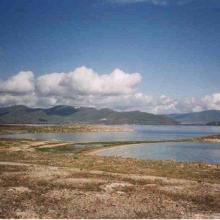


Lake Sevan
-
Country:Armenia
-
Designation date:07-06-1993
-
Site number:620
-
Published since:13 year(s)
490,231 ha -
-

Planalto Central de São Jorge
-
Country:Portugal
-
Designation date:16-06-2008
-
Site number:1807
-
Published since:15 year(s)
231 ha -
-
Planalto Central da Terceira
-
Country:Portugal
-
Designation date:16-06-2008
-
Site number:1805
-
Published since:15 year(s)
1,283 ha -
-
Cache-Lower White Rivers
-
Country:United States of America
-
Designation date:21-11-1989
-
Site number:442
-
Published since:10 year(s)
99,166 ha -