Mires of the Schwarzenberg
Mires of the Schwarzenberg
- Country:
- Austria
- Site number:
- 1369
- Area:
- 267.0 ha
- Designation date:
- 02-02-2004
- Coordinates:
- 47°04'59"N 13°46'59"E
Materials presented on this website, particularly maps and territorial information, are as-is and as-available based on available data and do not imply the expression of any opinion whatsoever on the part of the Secretariat of the Ramsar Convention concerning the legal status of any country, territory, city or area, or of its authorities, or concerning the delimitation of its frontiers or boundaries.
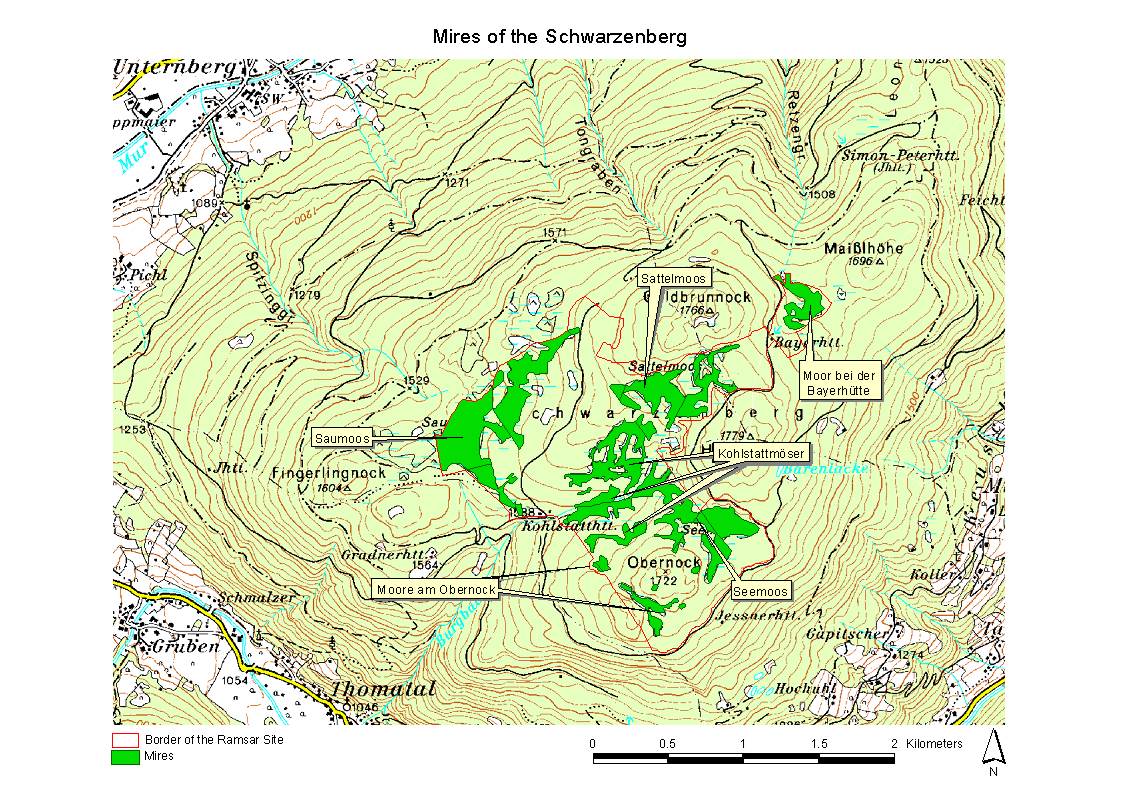
Mires of the Schwarzenberg. 02/02/04; Salzburg; 267 ha; 47°05'N 013°47'E. In the subalpine continental climate similar to the boreal, the plateau summit of the Schwarzenberg (1730m) has offered ideal conditions for the development of a natural mire complex of about 80 ha showing typical features of both boreal and alpine peatlands. Paludification mires, spring fens, percolation mires, Aapa mires and bogs present a high biodiversity of plant communities. Boreal vegetation such as the Dwarf Birch (Betula nana), bog cranberry species (Vaccinium microcarpum, Vaccinium oxycoccos) and the Crowberry-Brown Peatmoss (Empetro hermaphroditi-Sphagnetum fusci) are frequent occurrences, as is typical peatland vegetation like Carex pauciflora, Drosera rotundifolia, Menyanthes trifoliata and numerous Sphagnum species. The management authority (Austrian Federal Forestry) intends that there will be no peat extraction, no drainage of mires, no building of forestry roads affecting them, but a non-intensive forestry in the marginal forests and the preclusion of grazing and trampling of the mires. Ramsar site no. 1369. Most recent RIS information: 2003.
Administrative region:
Salzburg
Last publication date:
02-02-2004
Ramsar Information Sheet (RIS)
- AT1369RIS.pdf
- AT1369_map161128.jpg
- AT1369_taxo161128.pdf
Site map
Additional reports and documents
Taxonomic lists of plant and animal species occurring in the site
Other published literature