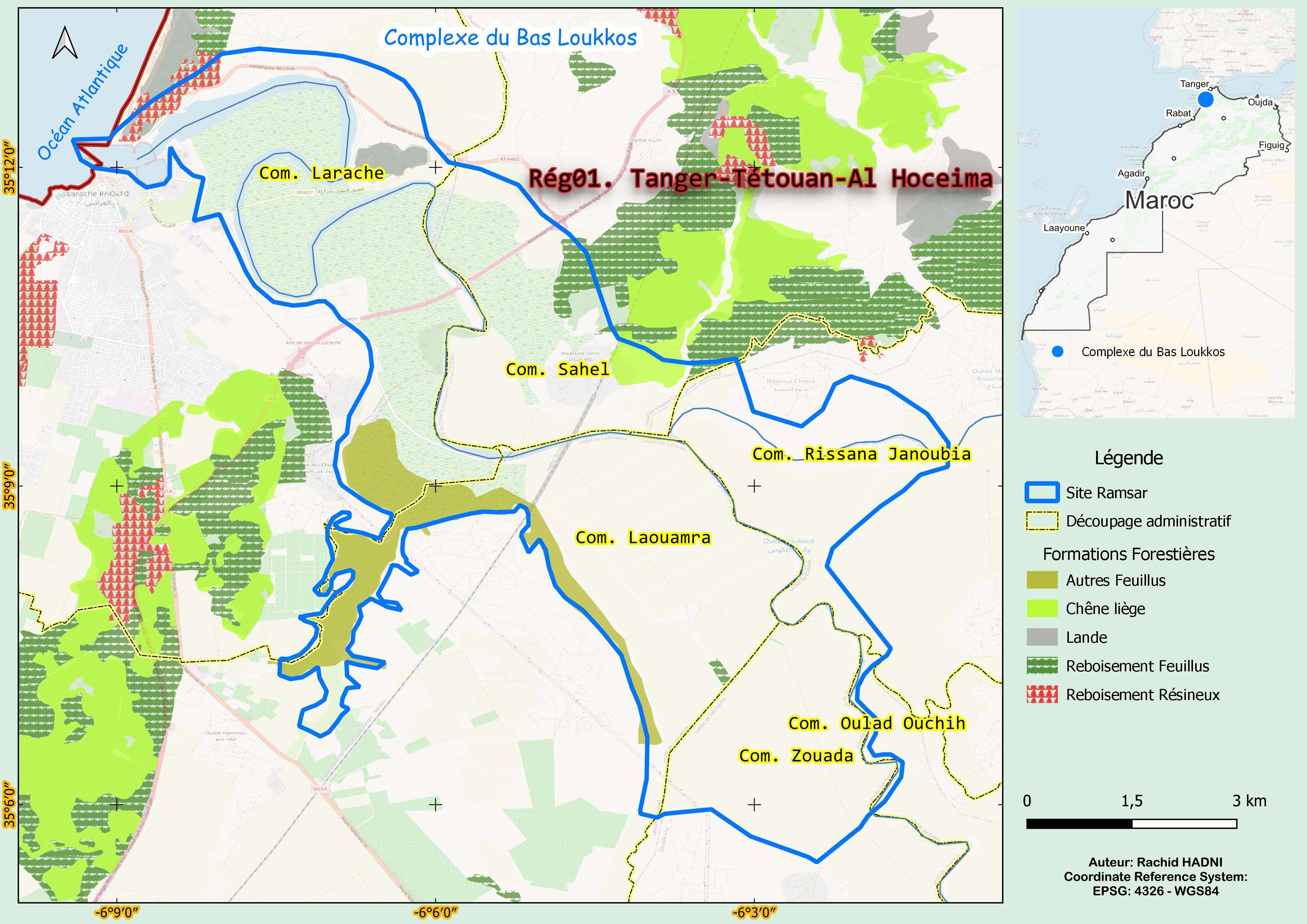
Complexe du bas Loukkos
Complexe du bas Loukkos
- Country:
- Morocco
- Site number:
- 1475
- Area:
- 6,630.0 ha
- Designation date:
- 15-01-2005
- Coordinates:
- 35°09'27"N 06°04'51"W
Carousel
Carousel


Materials presented on this website, particularly maps and territorial information, are as-is and as-available based on available data and do not imply the expression of any opinion whatsoever on the part of the Secretariat of the Ramsar Convention concerning the legal status of any country, territory, city or area, or of its authorities, or concerning the delimitation of its frontiers or boundaries.
This complex of wetlands is made up of estuaries, salt flats, salt pans, freshwater marshes with abundant aquatic plants, and flooded areas in the lower reaches of the Loukkos wadi. The complex is bordered by irrigated farmland, notably rice fields that have replaced wetlands which have been drained. At the river’s mouth, extensive salt pans dominate the landscape; however, most are now abandoned, with only a few remaining operational. This unique wetland is home to the rare swamp iris (Iris pseudoacorus) and provides a vital habitat for the European otter (Lutra lutra), a species listed under CITES Appendix I. The Site supports critically endangered species such as the European eel (Anguilla anguilla) and various threatened waterbird species, including the marbled teal (Marmaronetta angustirostris), purple heron (Ardea purpurea) and crested coot (Fulica cristata). The Site also delivers essential ecosystem services, such as supplying drinking water to the local community and providing natural flood control. The site is also valued for recreational activities such as hunting and fishing, for its cultural heritage, and for its role in scientific research.
- Site of Biological and Ecological Interest
- Zone of Interest for the Conservation of Birds
- MA1475RIS_2501_fr.pdf
- MA1475RISformer_220825.pdf
- MA1475_map230605.jpg
- MA1475_taxo161007.docx