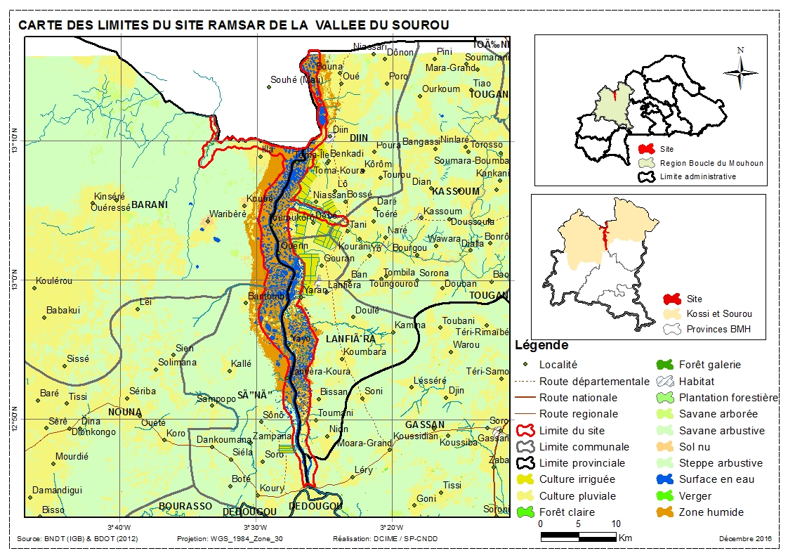
La Vallée du Sourou
La Vallée du Sourou
- Country:
- Burkina Faso
- Site number:
- 1885
- Area:
- 21,157.0 ha
- Designation date:
- 07-10-2009
- Coordinates:
- 13°00'51"N 03°27'44"W
- Transboundary Site:
Carousel
Carousel

 aménagé dans le cadre du Millenium Challenge Account (MCA)")


Materials presented on this website, particularly maps and territorial information, are as-is and as-available based on available data and do not imply the expression of any opinion whatsoever on the part of the Secretariat of the Ramsar Convention concerning the legal status of any country, territory, city or area, or of its authorities, or concerning the delimitation of its frontiers or boundaries.
The Sourou is a tributary of the largest river in Burkina Faso, the Black Volta, and is found in the Sudano-Guinean region where water is often scarce. As a result, it is important for its support of threatened species such as the hippopotamus and the African mahogany Khaya senegalensis. A total of 39,669 birds have been counted on the Site, including 60 bird species belonging to 18 families. These included the goose and duck species Plectropterus gambensis, Sarkidiornis melanotos, Alopochen aegyptiacus, Nettapus auritus, Dendrocygna bicolor and Dendrocygna viduata. As the only large water body in the region, the Sourou replenishes groundwater and stabilizes the temperature, allowing for cultivation. Cotton production was originally planned for the valley, but the riverside land has been turned over to vegetable crops, notably green beans as well as maize, rice and onions. With continual growth in the human population, the pressure on its resources is increasing, leading to excessive cutting of wood, water pollution due to overuse of fertilizers, and over-irrigation. The current agricultural practices are threatening the Site’s provision of ecological services including flood control, biodiversity conservation and climate regulation; however economic valuation of the goods and services provided by the Sourou valley’s ecosystem has revealed that crop production is not the major economic asset, despite the important investments since 1970.
- BF1885RIS_1704_fr.pdf
- BF1885RISformer_160725.pdf
- BF1885_map161216.jpg
- BF1885_taxo161216.xlsx
- BF1885_taxo161221.xlsx