Stary Zhaden
Stary Zhaden
- Country:
- Belarus
- Site number:
- 2140
- Area:
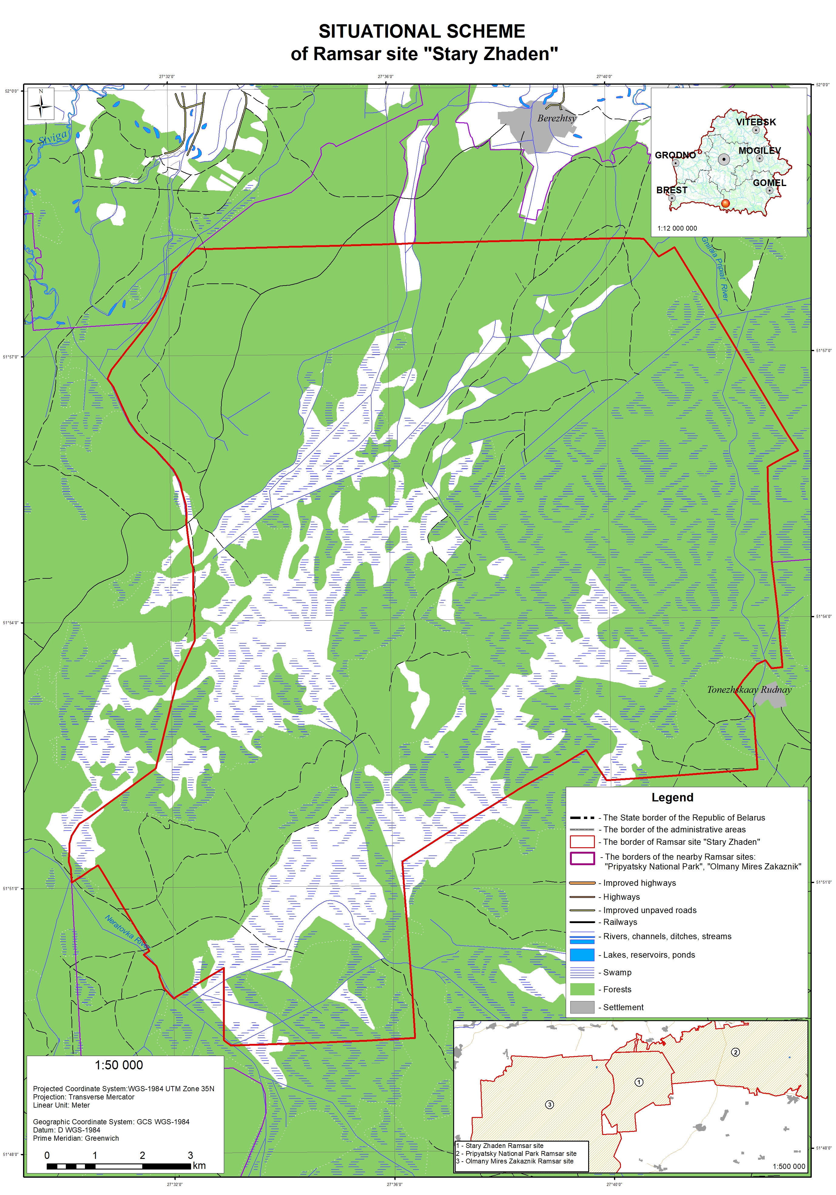
- 17,048.0 ha
- Designation date:
- 07-09-2012
- Coordinates:
- 51°54'22"N 27°36'37"E
Carousel
Carousel


Materials presented on this website, particularly maps and territorial information, are as-is and as-available based on available data and do not imply the expression of any opinion whatsoever on the part of the Secretariat of the Ramsar Convention concerning the legal status of any country, territory, city or area, or of its authorities, or concerning the delimitation of its frontiers or boundaries.
The Site lies in the south of Belarus, between the Pripyat River and its tributaries the Stviga and Ubort. It provides an important “green corridor” between the Pripyatsky National Park and Olmany Mires Zakaznik Ramsar Sites; together these three Sites comprise the Pripyatskoe Polesie Biosphere Reserve. Stary Zhaden is dominated by fens combined with sphagnum-dominated bogs and transitional boreal mires which are typical of the Belarusian Polesie region. The wetland is criss-crossed by a network of overgrown canals and ditches created at the end of the 19th century. The mires and islands are bordered by swampy, waterlogged and dry forests. The Site is characterized by a rich biodiversity including 17 species which are nationally listed as vulnerable or endangered. The Site plays important hydrological roles in water purification, maintenance of groundwater levels and water supply during the dry season. Besides commercial beekeeping, collecting of berries and mushrooms within the wetland are important sources of income for the local population. The main factors threatening its ecological character are logging, fires, drainage, poaching, recreational disturbances caused by the large-scale collection of berries and mushrooms, and residual radioactive contamination caused by the 1986 accident at the Chernobyl nuclear power plant.
- Wetland Reserve of Republican Importance - Stary Zhaden
- BY2140RIS_2101_en.pdf
- BY2140RISformer_200102.pdf
- BY2140_map200214.jpg