Sebkhat Imlili
Sebkhat Imlili
- Country:
- Morocco
- Site number:
- 2323
- Area:
- 1,774.0 ha
- Designation date:
- 12-01-2018
- Coordinates:
- 23°14'54"N 15°55'32"W
Carousel
Carousel


Materials presented on this website, particularly maps and territorial information, are as-is and as-available based on available data and do not imply the expression of any opinion whatsoever on the part of the Secretariat of the Ramsar Convention concerning the legal status of any country, territory, city or area, or of its authorities, or concerning the delimitation of its frontiers or boundaries.
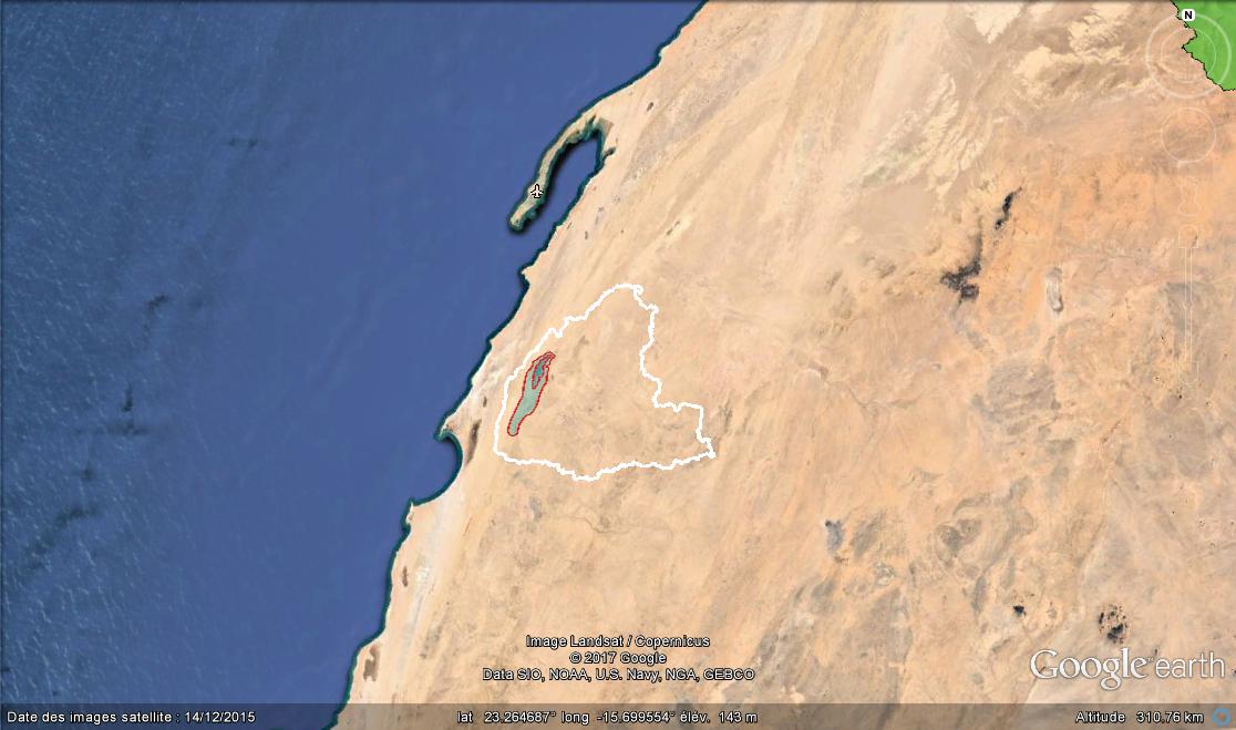
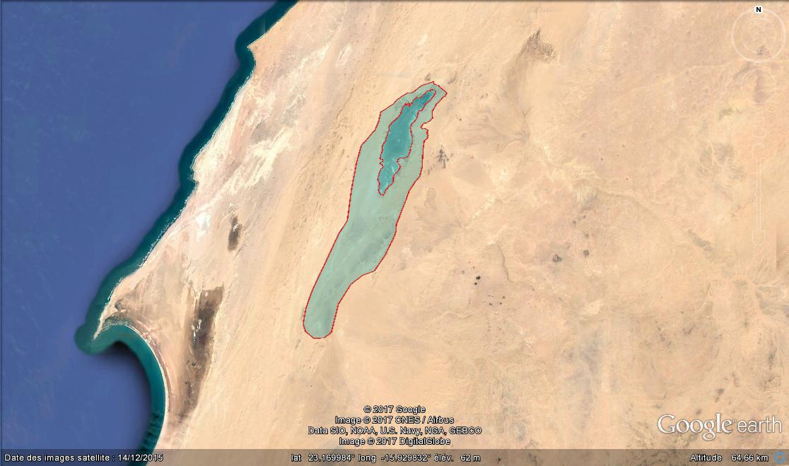
The Site is a relic of an original Saharan aquatic system, which bears witness to the recent tropical past of the extreme south of Morocco. The sebkha (salt flat) is in an area of limited and irregular rainfall over ten kilometres from the Atlantic Ocean. In its northern part are more than 160 permanent water pockets. The water is salty or hypersaline, but the pockets are home to aquatic flora and fauna with origins in marine, stagnant freshwater and flowing freshwater environments. Notably, these include a locally endemic fish of the Cichlidae family, which is related to the Guinean tilapia Coptedon guineensis, and some rare plant species. About 50 species of birds visit the site more or less regularly, especially migrants attracted by its greenery and water-related features.
- MA2323RIS_1802_fr.pdf
- MA2323_map180108.jpg
- MA2323_map180108_1.jpg
- MA2323_taxo180110.pdf
- MA2323_taxo180110_1.pdf