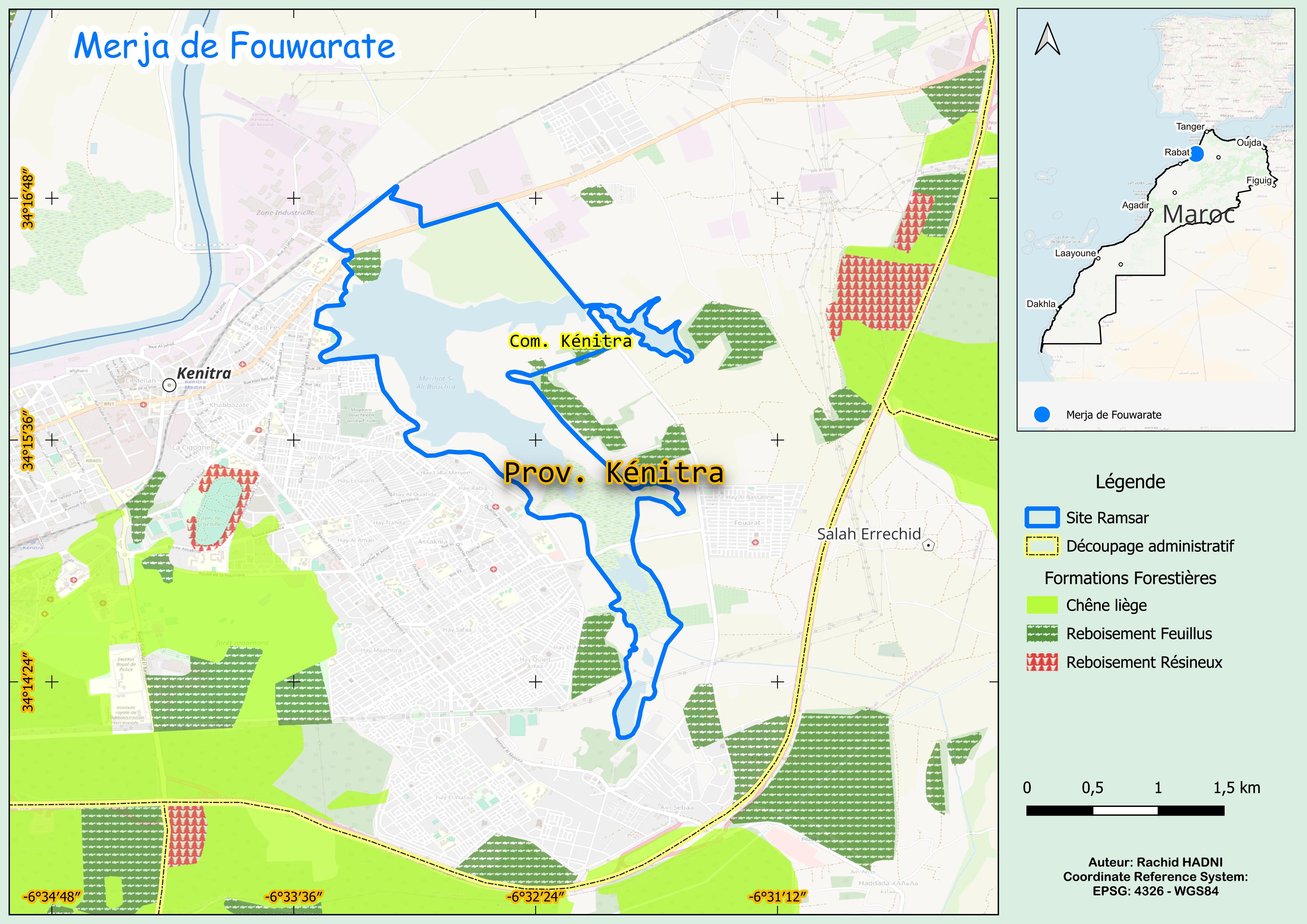
Merja de Fouwarate
Merja de Fouwarate
- Country:
- Morocco
- Site number:
- 2324
- Area:
- 460.0 ha
- Designation date:
- 12-01-2018
- Coordinates:
- 34°15'53"N 06°32'34"W
Carousel
Carousel


Materials presented on this website, particularly maps and territorial information, are as-is and as-available based on available data and do not imply the expression of any opinion whatsoever on the part of the Secretariat of the Ramsar Convention concerning the legal status of any country, territory, city or area, or of its authorities, or concerning the delimitation of its frontiers or boundaries.
This shallow swamp on the northeastern edge of Kénitra is the last remnant of a once-extensive wetland in the Gharb plain. It lies at the outlet of Oued Fouwarate, a tributary of the lower Oued Sebou, and serves as a vital year-round habitat for waterbirds. Over 60 species use the site for nesting, stopovers, and wintering, with populations exceeding 20,000 during migration and winter months. Several rare and threatened species contribute to its high conservation value, including the white-headed duck (Oxyura leucocephala), marbled teal (Marmaronetta angustirostris), ferruginous duck (Aythya nyroca), red-knobbed coot (Fulica cristata), and Eurasian curlew (Numenius arquata). In the 1990s, the site was nearly dry and severely degraded, but hydrological improvements in the early 2000s restored aquatic vegetation, which now covers up to 30% of the area and provides essential nesting habitat. Scattered tamarisk, acacia, and eucalyptus trees further enhance the Site’s biodiversity. Despite its rich biodiversity, the marsh lacks strong legal protection beyond its designation as a Site of Biological and Ecological Interest. Its peri-urban location makes it vulnerable to habitat loss from drainage, filling, urban expansion, and pollution. However, it has potential for environmental education and sustainable tourism, which could support conservation efforts.
- Site d'Intérêt Biologique et Ecologique de priorité 3 - Oued Fouarat
- MA2324RIS_2503_fr.pdf
- MA2324RISformer_190521_1802_fr.pdf
- MA2324_map240507.jpg
- MA2324_taxo180108.pdf
- MA2324_descr180108.pdf