


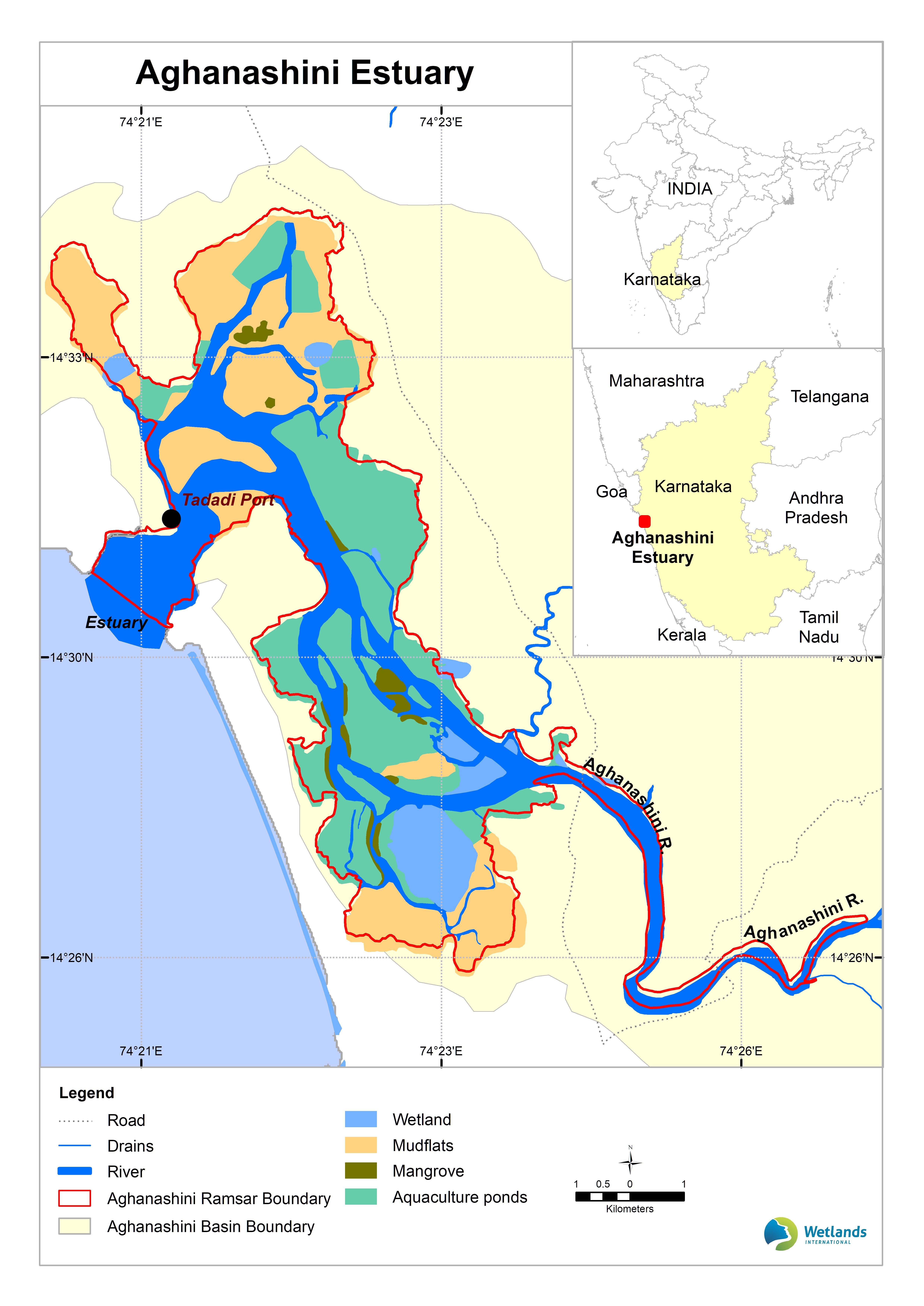
Aghanashini Estuary
- Country:India
- Site number:2534
- Area:4,801 ha
- Designation date:14-02-2023
- Coordinates:14°30'N 74°22'E
Materials presented on this website, particularly maps and territorial information, are as-is and as-available based on available data and do not imply the expression of any opinion whatsoever on the part of the Secretariat of the Ramsar Convention concerning the legal status of any country, territory, city or area, or of its authorities, or concerning the delimitation of its frontiers or boundaries.
Overview
The Site is an estuary where the Aghanashini River flows into the Arabian Sea in Karnataka State. In addition to its estuarine and shallow marine waters, it features rocky and pebble shores, intertidal mudflats and some aquaculture ponds and rice fields. These diverse environments provide habitats to more than 80 fish, 115 birds and 45 mangroves and mangrove-associated species, including globally threatened species such as halavi guitarfish (Glaucostegus halavi), lesser adjutant (Leptoptilos javanicus) and Indian river tern (Sterna aurantia). A majority of the fish species found at the Site are able to adapt to a wide range of saline environments, while some are migratory and only enter the Site for spawning or during early life stages. About 55,000 individual birds and more than 1% of the regional populations of nine bird species have been recorded here, including almost 10% of the regional population of black-headed ibis (Threskiornis melanocephalus). The Site supports the livelihoods of more than 6,000 households, who are engaged in activities such as fishing, agriculture, shrimp aquaculture, bivalve shell mining and salt production. In the estuary, farmers practice traditional farming to grow a salt-tolerant rice called “kagga”, which is one of the specialities of the region.
Administrative region:
Kumta Taluk, Uttara Kannada District, Karnataka State, India
- Last publication date:31-01-2024
Downloads
Ramsar Information Sheet (RIS)
Site map
Additional reports and documents
- Taxonomic lists of plant and animal species occurring in the site
- Other published literature