Península Mitre
Península Mitre
- Country:
- Argentina
- Site number:
- 2557
- Area:
- 369,417.0 ha
- Designation date:
- 20-08-2024
- Coordinates:
- 54°45'15"S 65°54'29"W
Carousel
Carousel


, arbustos en flor de Chiliotrichum diffusum y por detrás el bosque siempre verde de Nothofagus betuloides")


")

 con abundantes lagunas. Se destaca el bosque en galería en márgenes de los afluentes que cruzan el valle en dirección prácticamente paralela.")


Materials presented on this website, particularly maps and territorial information, are as-is and as-available based on available data and do not imply the expression of any opinion whatsoever on the part of the Secretariat of the Ramsar Convention concerning the legal status of any country, territory, city or area, or of its authorities, or concerning the delimitation of its frontiers or boundaries.
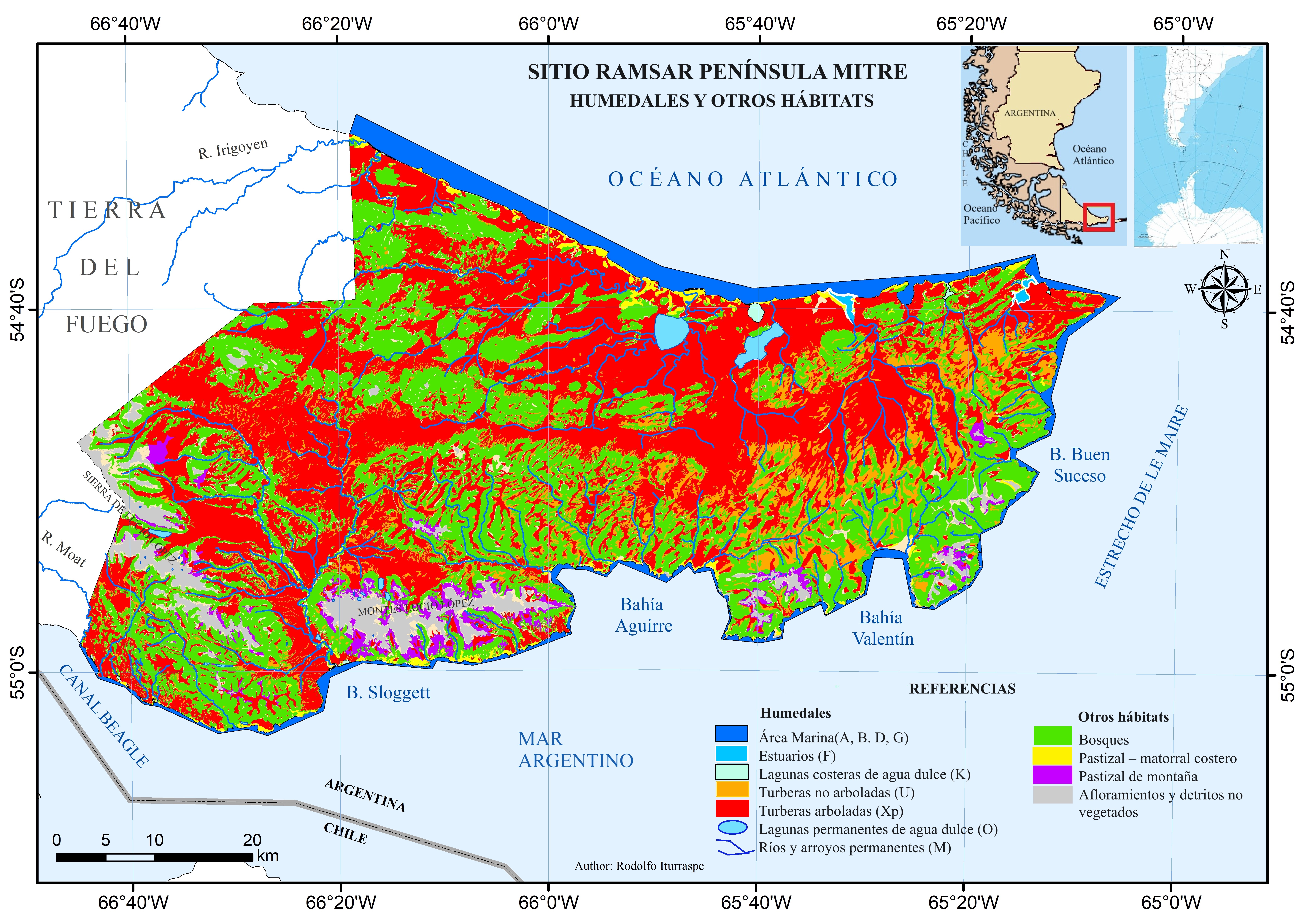
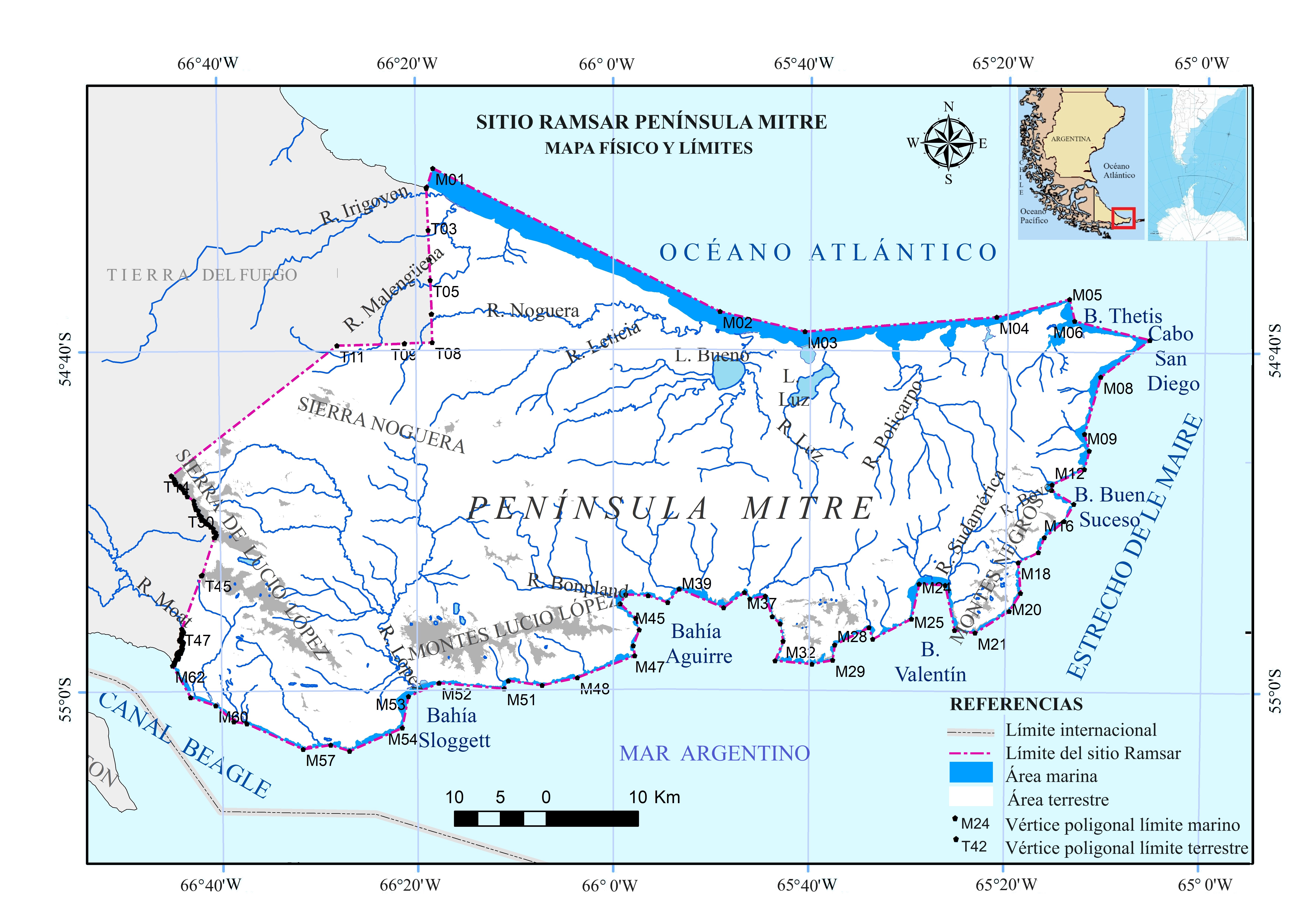
Situated at the southernmost tip of South America, the Site covers almost 370,000 hectares on the eastern Argentinian sector of Isla Grande de Tierra del Fuego. Its diverse landscapes include native Nothofagus forests, rare blanket bog peatlands, and coastal and marine ecosystems such as forests of giant kelp Macrocystis pyrifera and meadows of southern bull kelp Durvillaea antarctica. The Site entirely falls within the Península Mitre Natural Protected Area. The Site’s location at the confluence of the Pacific, Atlantic and Circumpolar ocean currents creates a unique environment that fosters biodiversity and high levels of endemism. Its ecosystems serve as critical breeding grounds and shelters for numerous species. Among the rare and endemic animals found are the endangered southern river otter (Lontra provocax) and marine otter (Lontra felina), and the vulnerable southern rockhopper penguin (Eudyptes chrysocome). The Site also supports endemic plant species such as Astelia pumila, Donatia fascicularis and Drosera uniflora. The Site plays a vital role in mitigating climate change through its peatlands and kelp forests, which function as natural carbon sinks. Its vegetation also prevents soil erosion and limits sediment runoff into rivers and coastal waters, preserving its ecosystems. Adding to its significance, the Site hosts archaeological sites that provide evidence of human presence dating back 6,000 years, offering valuable insights into the lives of the region’s earliest inhabitants.
- Área Natural Protegida - Península Mitre
- Área de preservación s/ Ordenamiento de Turberas – Res. SDSyA TDF No 401/2011 - Zona de Preservación A2
- AR2557RIS_2502_es.pdf
- AR2557_map240603.jpg
- AR2557_map240603_1.jpg