Flood Plain Lower Ringarooma River
Flood Plain Lower Ringarooma River
- Country:
- Australia
- Site number:
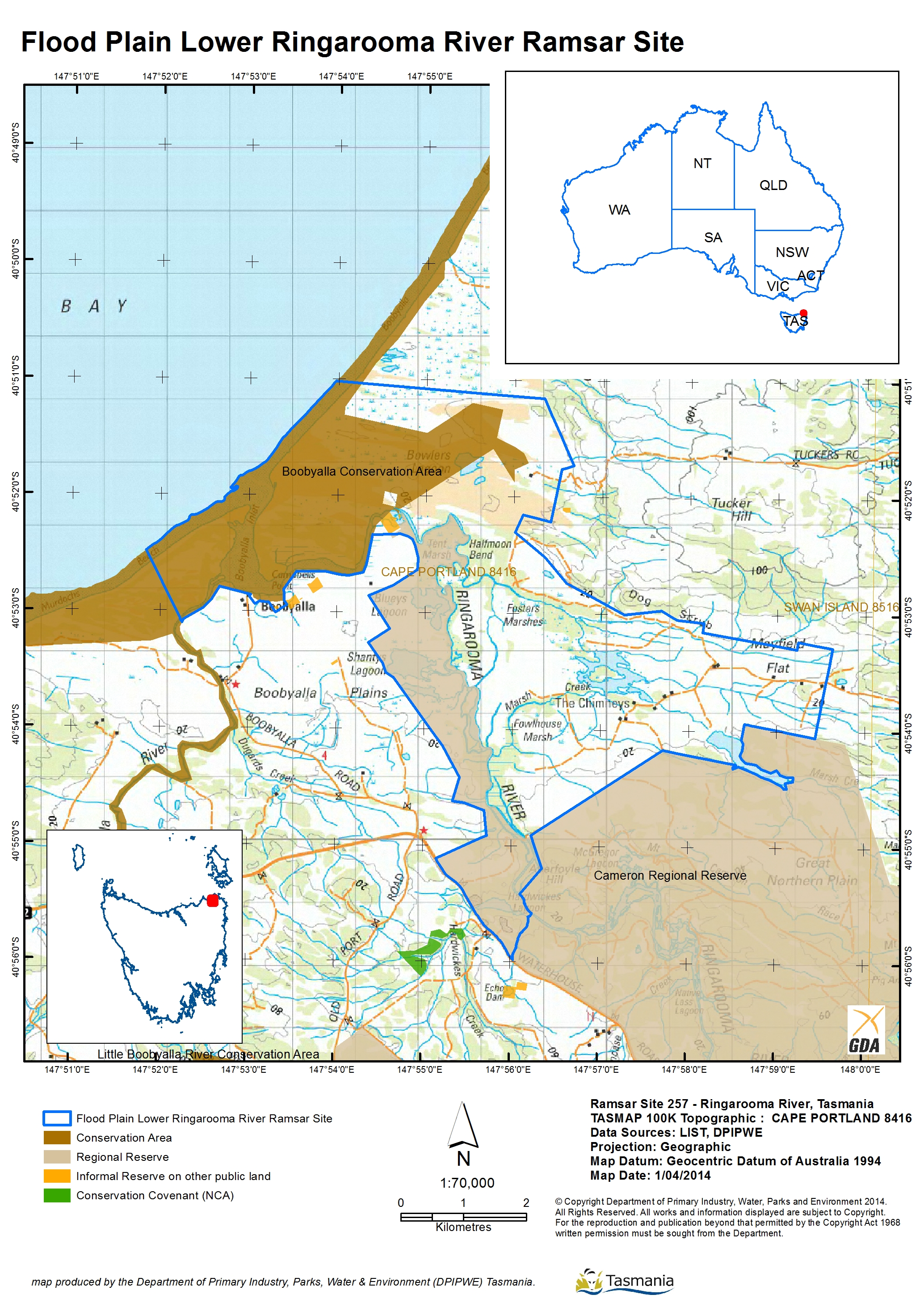
- 257
- Area:
- 3,534.0 ha
- Designation date:
- 16-11-1982
- Coordinates:
- 40°53'01"S 147°55'42"E
Carousel
Carousel


Materials presented on this website, particularly maps and territorial information, are as-is and as-available based on available data and do not imply the expression of any opinion whatsoever on the part of the Secretariat of the Ramsar Convention concerning the legal status of any country, territory, city or area, or of its authorities, or concerning the delimitation of its frontiers or boundaries.
The Site is a rare wetland within the Tasmanian drainage basin. Unusually for a large river in Tasmania, it flows through flood plains and forms a mosaic of wetlands including permanent and seasonal marshlands and a large river estuary. The Site hosts plant communities recognized as rare or threatened under Tasmanian legislation, such as freshwater aquatic sedgeland and rushland, and Melaleuca ericifolia swamp forest. It also supports a range of globally and nationally threatened species such as green and gold frog (Litoria raniformis), fairy tern (Sternula nereis) and dwarf galaxias (Galaxiella pusilla). The lagoons, marshlands and dunes support a rich variety of invertebrate fauna. The shallow freshwater lagoons are also important feeding and nesting areas for many migrating waterbirds. Hydrological services provided by the Site include the retention of flood waters and the trapping of mine-related sediment. As of 2023, the Site’s management plan was supporting projects to improve and protect the floodplains and Melaleuca swamp forest.
- State Conservation Area - Boobyalla Conservation Area
- State Regional Reserve - Cameron Regional Reserve
- AU257RIS_2304_en.pdf
- AU257RISformer_150123.pdf
- AU257RISformer_190603_1206_en.pdf
- AU257RISformer_0506_en.pdf
- AU257_map1502.jpg
- AU257ECD2013.pdf
- AU257_mgt210427.pdf