Hattah-Kulkyne Lakes
Hattah-Kulkyne Lakes
- Country:
- Australia
- Site number:
- 264
- Area:
- 955.0 ha
- Designation date:
- 05-04-1983
- Coordinates:
- 34°43'24"S 142°22'40"E
Carousel
Carousel
Materials presented on this website, particularly maps and territorial information, are as-is and as-available based on available data and do not imply the expression of any opinion whatsoever on the part of the Secretariat of the Ramsar Convention concerning the legal status of any country, territory, city or area, or of its authorities, or concerning the delimitation of its frontiers or boundaries.
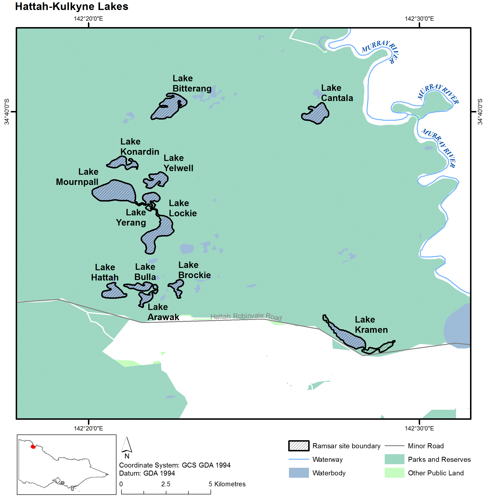
A lake system set in an extensive wetland with a complex flood hydrology operating on a two- to seven-year cycle. When flooded, the lakes become important breeding areas for egrets, cormorants and darters. The area supports several bird, fish and plant species that are endangered, rare or vulnerable in the State of Victoria. Murray River water is used for irrigation purposes.
- UNESCO Biosphere Reserve
- national park - Hattah-Kulkyne National Park
- AU264RIS_2207_en.pdf
- AU264RISformer1998_EN.pdf
- AU264RISformer_151029.pdf
- AU264_map1606.png
- AU264ECD2013.pdf
- AU264_mgt210504.pdf