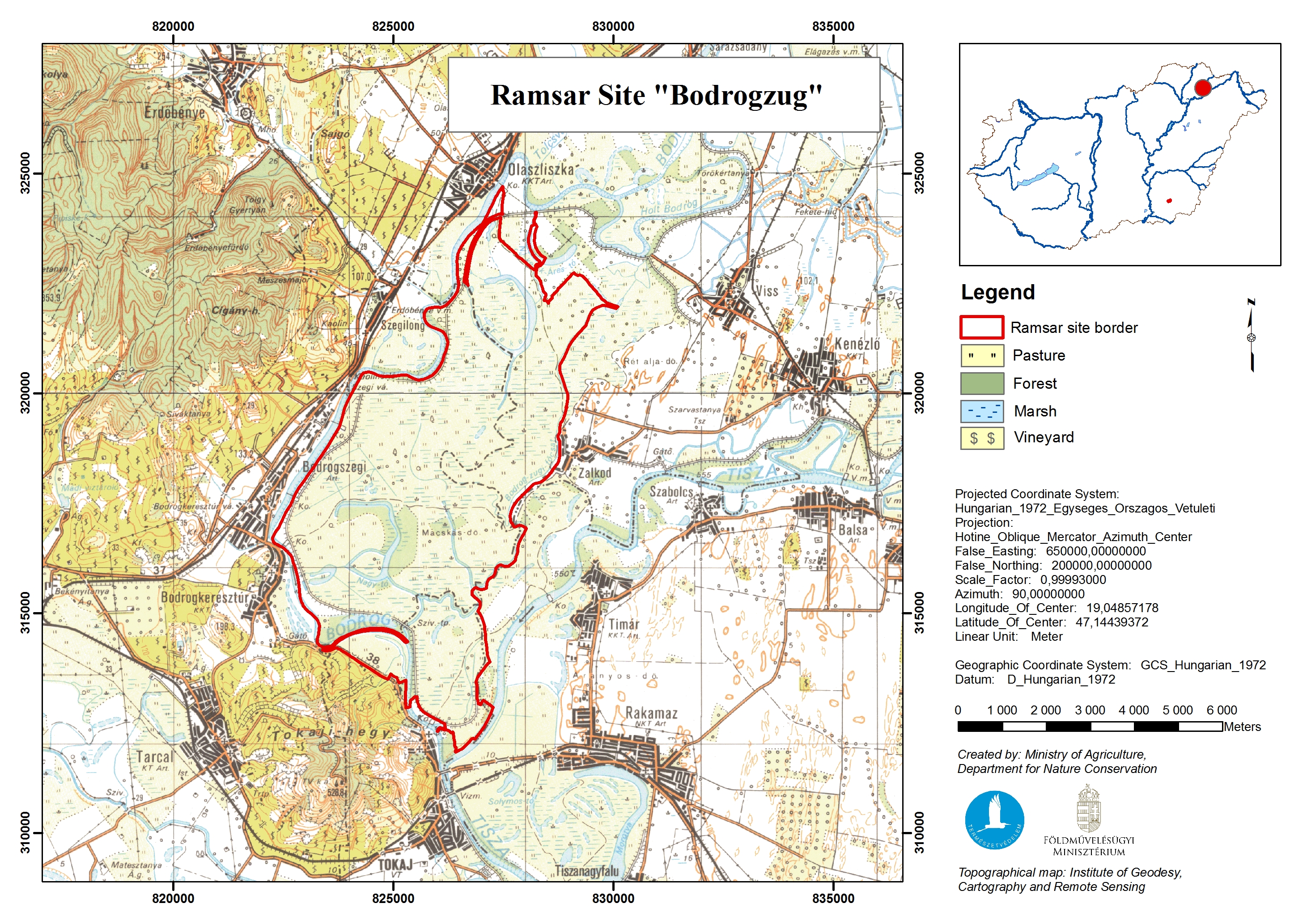
Bodrogzug
Bodrogzug
- Country:
- Hungary
- Site number:
- 422
- Area:
- 4,220.0 ha
- Designation date:
- 17-03-1989
- Coordinates:
- 48°10'52"N 21°24'53"E
Carousel
Carousel
")

Materials presented on this website, particularly maps and territorial information, are as-is and as-available based on available data and do not imply the expression of any opinion whatsoever on the part of the Secretariat of the Ramsar Convention concerning the legal status of any country, territory, city or area, or of its authorities, or concerning the delimitation of its frontiers or boundaries.
This Site characterized by grassland, marshland and areas of woodland supports hygrophilous plant communities which are important for maintaining the biological diversity of the Pannonian biogeographic region. It is one of the best-preserved open floodplains in the country, and includes several lakes at the confluence of the Tisza and Bodrog rivers. More than 250 bird species use the Site for nesting, as refuge during winter, and as a resting ground during migration. The Site also supports threatened species such as the globally vulnerable great raft spider Dolomedes plantarius and mammals including the European otter Lutra lutra, and is an important spawning ground for fish. It plays an important role in flood control and local climate regulation, supporting the local production of the renowned Tokaji wine. The Site is used for recreational hunting and fishing, and the ruins of the Rákóczi Castle at the mouth of the Bodrog river add historical value. The main threats are posed by invasive plant species, while the Site has been recovering from the inflow of cyanide-polluted waters from the Szamos and Tisza rivers, caused by a gold mine spill near Baia Mare in Romania in 2000.
- landscape protection area - Tokaj-Bodrogzug Landscape Protection Area
- EU Natura 2000