Warta River Mouth National Park
Warta River Mouth National Park
- País:
- Polonia
- Número del sitio:
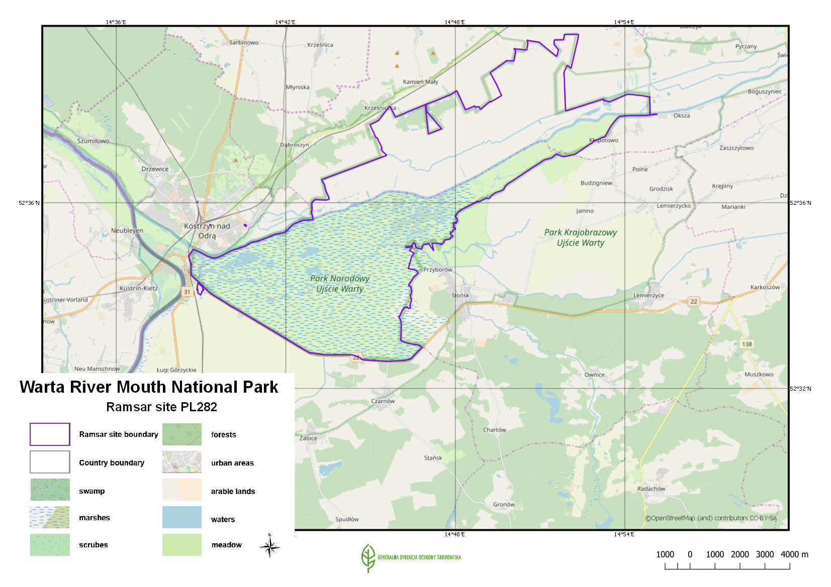
- 282
- Superficie:
- 7,956.0 ha
- Fecha de designación:
- 03-01-1984
- Coordenadas:
- 52°35'51"N 14°46'12"E
Carousel
Carousel


Los materiales presentados en este sitio web, particularmente los mapas y la información territorial, se proporcionan tal cual y según están disponibles a partir de los datos de los que se dispone y no implican la expresión de opinión alguna por parte de la Secretaría de la Convención de Ramsar respecto de la condición jurídica de ningún país, territorio, ciudad o zona, ni de sus autoridades, ni respecto de la delimitación de sus límites o fronteras.
The Site covers the Warta River floodplain, near the border with Germany, and the surrounding marshes, meadows and pasture. It is one of the most important areas for waterfowl in Central Europe. The Park has a characteristic open landscape of seasonally flooded meadows and pastures, dotted with willows and criss-crossed by a dense network of river channels, ditches, canals, oxbows and small reservoirs. The annual fluctuation in the river level is as great as 3.5 metres, and the regular flooding favours the development of particular vegetation which creates the appropriate conditions for supporting a large concentration of migrating birds. It is also an important moulting site for geese, ducks, swans and cranes, and of the 279 species of bird recorded within the Park, more than 170 use the Site for breeding. An education centre, which organizes activities such as excursions and lectures, is found in the management headquarters of the Site. As of 2018, a management plan was being prepared.
- National Park - Warta River Mouth
- Natura 2000 (Unión Europea)
- PL282RIS_1907_en.pdf
- PL282RISformer.pdf
- PL282RISformer_170710.pdf
- PL282_map180928.png