Warta River Mouth National Park
Warta River Mouth National Park
- Country:
- Poland
- Site number:
- 282
- Area:
- 7,956.0 ha
- Designation date:
- 03-01-1984
- Coordinates:
- 52°35'51"N 14°46'12"E
Carousel
Carousel


Materials presented on this website, particularly maps and territorial information, are as-is and as-available based on available data and do not imply the expression of any opinion whatsoever on the part of the Secretariat of the Ramsar Convention concerning the legal status of any country, territory, city or area, or of its authorities, or concerning the delimitation of its frontiers or boundaries.
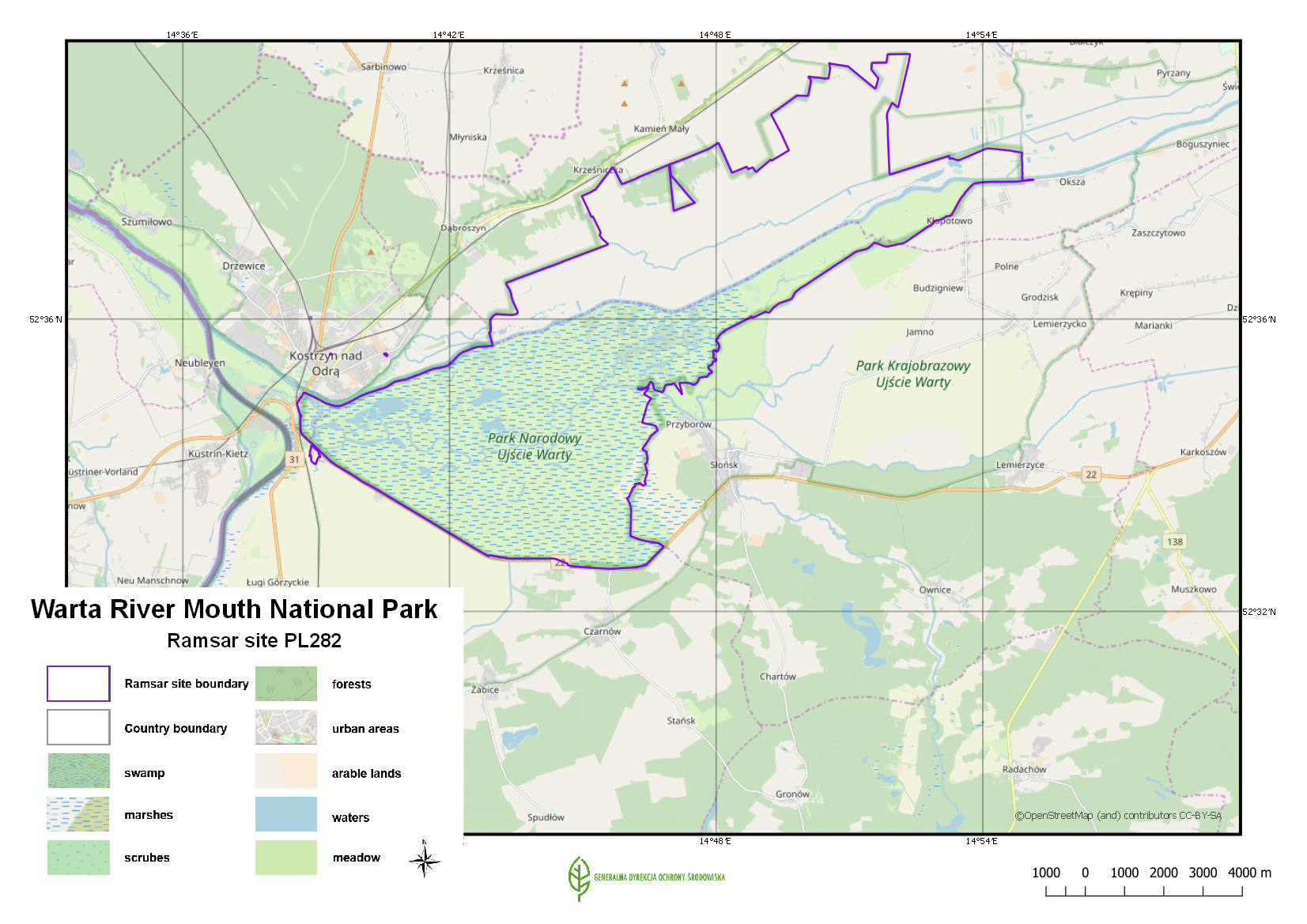
The Site covers the Warta River floodplain, near the border with Germany, and the surrounding marshes, meadows and pasture. It is one of the most important areas for waterfowl in Central Europe. The Park has a characteristic open landscape of seasonally flooded meadows and pastures, dotted with willows and criss-crossed by a dense network of river channels, ditches, canals, oxbows and small reservoirs. The annual fluctuation in the river level is as great as 3.5 metres, and the regular flooding favours the development of particular vegetation which creates the appropriate conditions for supporting a large concentration of migrating birds. It is also an important moulting site for geese, ducks, swans and cranes, and of the 279 species of bird recorded within the Park, more than 170 use the Site for breeding. An education centre, which organizes activities such as excursions and lectures, is found in the management headquarters of the Site. As of 2018, a management plan was being prepared.
- National Park - Warta River Mouth
- EU Natura 2000
- PL282RIS_1907_en.pdf
- PL282RISformer.pdf
- PL282RISformer_170710.pdf
- PL282_map180928.png