


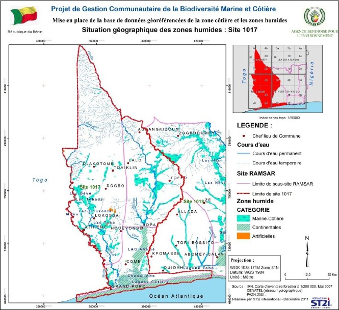
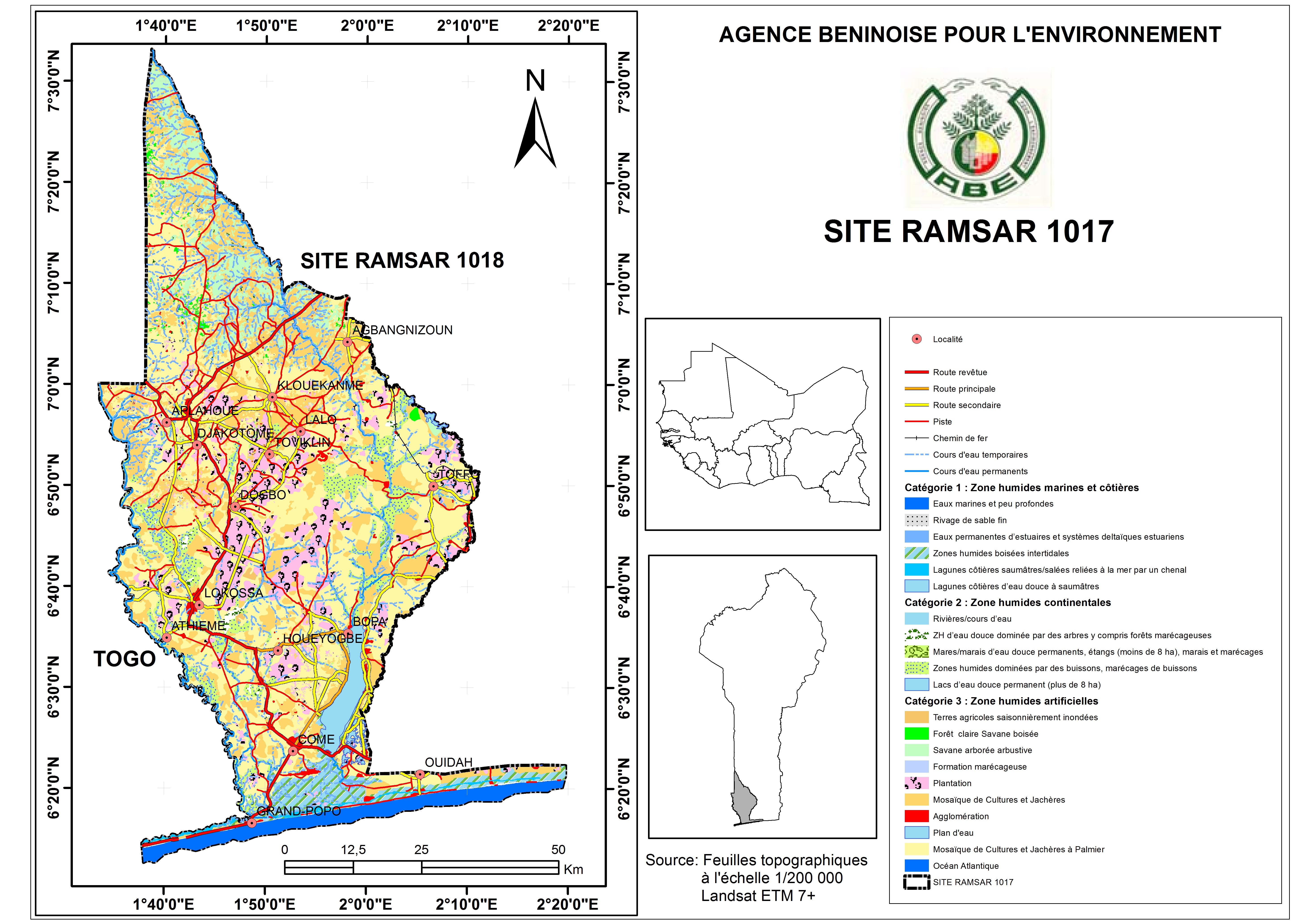
Basse Vallée du Couffo, Lagune Côtiere, Chenal Aho, Lac Ahémé
- Country:Benin
- Site number:1017
- Area:524,289 ha
- Designation date:24-01-2000
- Coordinates:06°47'N 01°51'E
Materials presented on this website, particularly maps and territorial information, are as-is and as-available based on available data and do not imply the expression of any opinion whatsoever on the part of the Secretariat of the Ramsar Convention concerning the legal status of any country, territory, city or area, or of its authorities, or concerning the delimitation of its frontiers or boundaries.
Overview
The Site in southern Benin was extended in 2018, from the original area of 47,500 hectares designated in 2001, to cover over 524,000 ha, including the valleys of the Couffo, Mono and Sazué rivers. This Site and Ramsar Site no. 1018 “Basse Vallée de l'Ouémé, Lagune de Porto-Novo, Lac Nokoué” together now cover the entire coast of Benin, forming a vast and important complex of wetlands. The Site provides habitats for migrating turtles and birds, and spawning grounds for fish, crustaceans and molluscs. Its mangrove swamps, flooded grasslands and wooded savannah are home to around 233 bird species and over 90 fish species. The diverse fauna includes a number of threatened species such as hawksbill turtle (Eretmochelys imbricata), African manatee (Trichechus senegalensis), Brycinus carolinae (a ray-finned fish) and red-bellied monkey (Cercopithecus erythrogaster). 364 plant species have been counted, belonging to 100 families including Poaceae and Rubiaceae. Activities include tourism, the fishing sector which employs about 10,000 fishers, and production of salt, palm wine and corn. The sacred status of areas such as some mangroves adds social and cultural value to the Site. Major threats include the over-exploitation of the mangroves, soil erosion due to illegal logging, and coastal erosion. The Ramsar Site overlaps with the Mono UNESCO Biosphere Reserve, for which a management plan is being implemented with the participation of the local communities.
Administrative region:
Sur le plan administratif, le site 1017 s’étend sur quatre Départements : Atlantique, Mono, Couffo et Zou
- Global international designation:
- UNESCO Biosphere Reserve
- National legal designation:
- ACCB de la Bouche du Roy - Grand Popo
- Aire Communautaire de Conservation de la Biodiversité (ACCB) de Adjamey - Djakotomey
- Aire Communautaire de Conservation de la Biodiversité (ACCB) de la forêt de Naglanou - Athiémé
- Aire Communautaire de Conservation de la Biodiversité (ACCB) du Lac Toho - Athiémé, Lokossa et Houeyogbé
- Aire Communautaire de Conservation de la Biodiversité (ACCB) du Vodounto - Ouidah
- Last publication date:16-10-2019